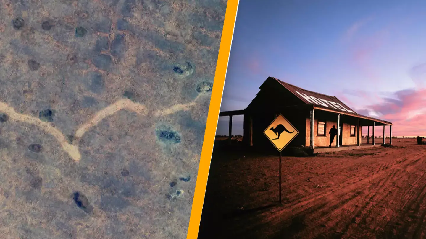
A man stumbled upon a significant finding when he noticed a large ‘scar’ in the Australian outback while viewing Google Maps.
Exploring Google Maps or Google Earth can be a pastime for some, and occasionally, this seemingly trivial activity can lead to fascinating discoveries.
Earlier in the year, a caver was examining satellite images of the Nullarbor Plain in southern Australia when he discovered something unusual.
The curious find was a ‘mysterious scar’ etched into the landscape, which intrigued scientists and sparked excitement about what could be uncovered ‘without the power of technology’.
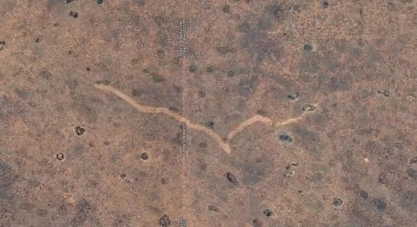
Dr. Matej Lipar, an Adjunct Research Fellow at Curtin’s School of Earth and Planetary Sciences, mentioned in the Daily Mail that the ‘scar was created by a powerful tornado that had gone unnoticed until now.’
The expert elaborated on how the tornado’s impact served as a ‘remarkable example of nature’s ferocity that was almost overlooked’.
To pinpoint the event’s timeline, the research team compared satellite imagery of the area over several years.
They concluded that the tornado occurred quite recently, from 16 to 18 November 2022.
Dr Lipar stated: “It’s crucial for scientists to predict tornadoes accurately, so we can alert communities in advance. Studying the Nullarbor tornado scar was beneficial for this purpose.
“The Nullarbor Plain is an expansive, arid, treeless region in southern Australia.
“The individual who discovered the scar was using Google Earth satellite imagery to search for caves or other karst features in the Nullarbor area.”
He explained: “Karst is a type of landscape characterized by limestone that forms unique landforms.
“The discovery of the scar was brought to the attention of my colleagues and me through a network of researchers and explorers focused on studying the Nullarbor karst.”
He further noted: “The scar extends from Western Australia across the border into South Australia.
“It is located 20 kilometers north of the Trans-Australian Railway and 90 kilometers east-northeast of Forrest, a former railway settlement.”
In May, Dr. Lipar and his colleagues visited the site to gain more insight into the findings.
“The site displays distinct patterns known as ‘cycloidal marks’, created by tornado suction vortexes. This indicates that the tornado was particularly intense, likely in the F2 or F3 category, with destructive winds exceeding 200 kilometers per hour,” Dr. Lipar added.