
This weekend, parts of the United States are bracing for severe weather as a ‘bomb cyclone’ snowstorm approaches.
Despite the hope that winter conditions might subside as February nears, the forecast suggests otherwise.
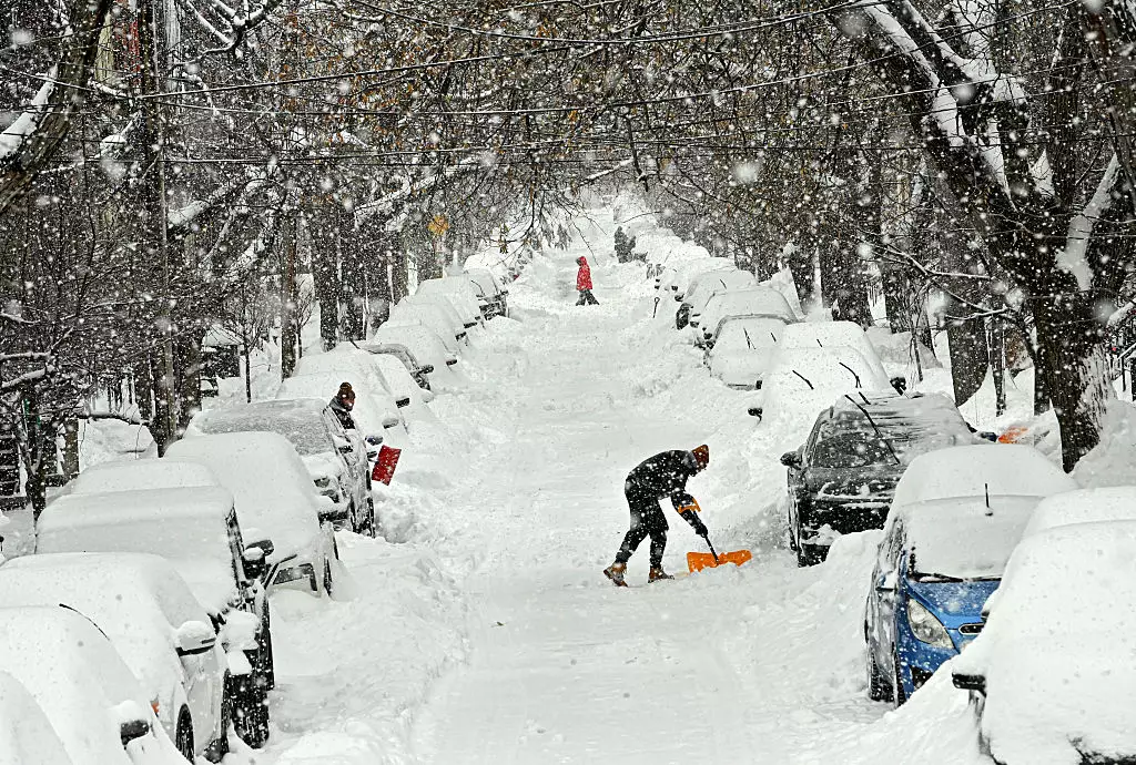
Just days after a significant storm dumped up to 30 inches of snow and resulted in several fatalities, the East Coast and Mid-Atlantic states are being advised to ‘prepare’ once again.
AccuWeather has alerted the public to the ‘possibility of dangerous blizzard conditions,’ with the storm’s influence possibly reaching as far as Florida.
Forecasters are expecting heavy snow, blizzard conditions, strong winds, coastal flooding, and extreme cold starting on Friday (January 30), initially affecting southern Ohio and the Tennessee Valley.
The storm is anticipated to intensify rapidly offshore by Saturday (January 31), bringing more snow and strong winds to the Mid-Atlantic region.
As per the Weather Channel, a storm gets classified as a ‘bomb cyclone’ when ‘the central pressure of a low-pressure system drops at least 24 millibars within 24 hours’.
The storm’s development is being fueled by a jet stream locked in a pattern that draws Arctic air deep into the US, and this is exacerbated by the cold air remaining from existing snow cover, according to the BBC.
Temperatures in some states could plunge 59F (15°C) below the typical average for the season, the publication notes.
Here’s what to anticipate across the US this weekend.
Florida, known for its subtropical climate and gentle winters, will experience a chill over the weekend, prompting residents to dress warmly.
While significant snow accumulation is not expected, minor snow flurries might occur in areas such as Tampa.
The region could witness record-breaking low temperatures, as National Weather Service meteorologist Ana Torres-Vazquez mentioned to ABC News.
“It looks like temperatures across South Florida are dipping into the 30s (F) for most of the metro area and maybe into the 20s for areas near Lake Okeechobee,” she stated.
Windchill may cause these temperatures to feel even colder.
North Carolina and Virginia could receive between six and 15 inches of snow.
According to AccuWeather meteorologist Alex Sosnowski, cities like Charlotte, Raleigh, and Greensboro in North Carolina might experience their ‘biggest snowstorm in decades’.
The National Weather Service (NWS) forecasts 8.4 inches of snow in Raleigh, 7 inches in Greensboro, and 6 inches in Charlotte.
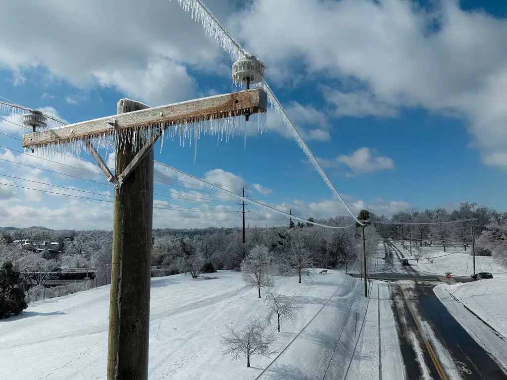
Strong winds and snow are expected to lead to further power outages and make travel conditions ‘dangerous or even impossible,’ the NWS warns.
In eastern West Virginia, country roads may not be accessible this weekend due to the snow.
The NWS indicates that snow is probable across North Georgia, eastern West Virginia, South Carolina, and Tennessee.
Additionally, strong winds are anticipated, capable of causing trees and power lines to fall, leading to travel disruptions.

This weekend, coastal areas of Delaware, New Jersey, and Maryland are likely to experience light snowfall, but the primary threat is expected to be strong winds.
Forecasts predict up to 2 inches of snow in Ocean City, Maryland, and around 1 inch in Dover, Delaware, and Atlantic City, New Jersey.
The National Weather Service has issued a warning that strengthening north to northeast winds could result in coastal flooding on Sunday (February 1), with gusts near hurricane force combining with high tides along the Mid-Atlantic coast.
By Sunday, the storm is likely to move northwards, affecting major northeastern cities like New York and Boston, as reported by the BBC.
However, there is still uncertainty regarding how far inland the heavy snow might reach.
Weather.com meteorologists Rob Shackelford and Jonathan Erdman suggest that the most probable area for receiving between 6 and 12 inches of snow in the Northeast includes southeastern Massachusetts, particularly Cape Cod, Martha’s Vineyard, and Nantucket.