

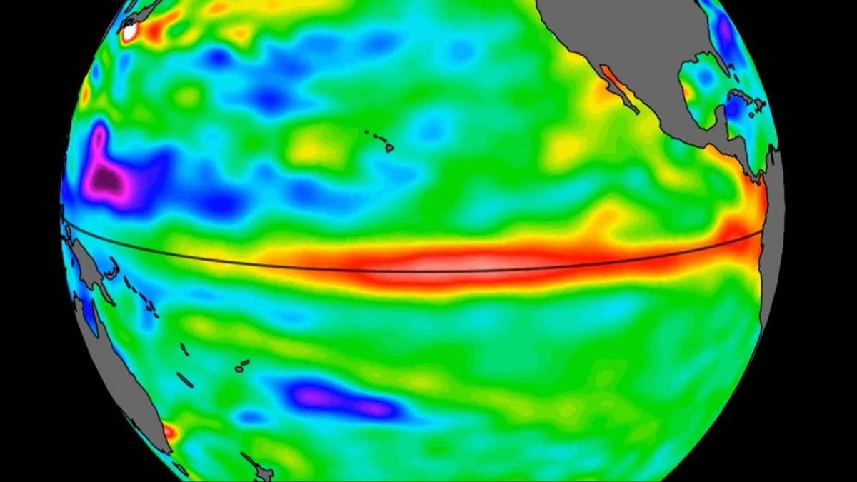
NASA has released new images showing what could become a Super El Niño, offering a clearer view of the conditions that may influence weather across North and South America.
The visuals reveal an expansive patch of unusually warm water spreading off the coast of South America—an indicator that this year could bring an especially intense El Niño event.
El Niño is driven by changes in ocean surface temperatures, and when those waters warm, the effects can ripple outward into broader atmospheric patterns. That shift can alter weather across much of North and South America.
Depending on where it develops and how it evolves, El Niño can be linked to a wide range of outcomes, from severe flooding in some regions to extended drought in others, and it can also affect patterns tied to hurricane activity.
Although El Niño is a naturally occurring cycle and not directly caused by climate change, scientists think rising global temperatures may intensify some of the extreme impacts associated with El Niño when it does occur.
The imagery comes from a joint effort involving NASA and the European Space Agency (ESA), using observations from the Sentinel-6 Michael Freillish satellite.

Sentinel-6 was launched in 2020 and is designed to measure sea-surface height across the entire ocean with extremely high precision—down to fractions of an inch—revisiting the same areas roughly every 10 days.
Those measurements can also help detect warm Kelvin waves, a key signal scientists monitor because they are strongly associated with the development of El Niño conditions.
Josh Willis, a project scientist for Sentinel-6 Michael Freilich and a sea level researcher at NASA’s Jet Propulsion Laboratory in Southern California, said the current event is progressing quickly despite a slower start than some past major episodes.
“While this year’s event started a bit later than the big El Niños of 2015 and 1997, it’s beginning to catch up,” he said, adding: “We’ll see how big it gets.”
El Niño refers to warming at the ocean’s surface—but what qualifies an event as a Super El Niño?

A Super El Niño is typically defined by ocean temperature anomalies that surge beyond a specific threshold—around two degrees Celsius or more (about 3.6 degrees Fahrenheit) above average in key regions.
“NASA’s observation of El Niño uses sea level satellites like Sentinel-6 Michael Freilich to track massive Kelvin waves as they cross the Pacific, capture changes in Earth’s ocean thermodynamics, improve forecasts of weather extremes, and help communities prepare for potential coastal hazards,”
Severine Fournier, deputy project scientist for Sentinel-6 Michael Freilich, emphasized that conditions and consequences vary from one event to the next, even if certain broad trends repeat.
“But they almost always make for a hot year and big changes in rainfall in parts of the globe.”