


An intensifying El Niño warming the equatorial Pacific Ocean is heading to historically strong levels, according to the National Oceanic and Atmospheric Administration. In its latest forecast update, NOAA said the current El Niño has an 81 percent chance of becoming “very strong”—the top category available—by fall. The event should rank among the most intense El Niños since weather tracking began in 1950.
Ocean temperatures in key parts of the Pacific that help indicate the El Niño’s strength are already at or near record highs for this time of year, driven partly by climate change warming the oceans globally. Scientists working on NOAA’s El Niño forecast team have called the conditions “pretty extreme” and “not unprecedented, but very unusual.” One researcher at the University of Miami said it will rival the catastrophic 1997-1998 El Niño, while others predict it could be even stronger. Some computer models suggest this El Niño could become the strongest recorded since instrumental observations began decades ago.
The developing event formed only last month but quickly advanced past the weak stage and is now considered moderate with no signs of slowing its strengthening, NOAA forecasters said. Ocean conditions are continuing to intensify in the coming months, with forecasters expecting El Niño to reach peak strength between late fall and early winter 2026-27. The World Meteorological Organization warned that the most rapid intensification is likely to occur during July through September, with impacts spreading globally through the Northern Hemisphere autumn.
Current model projections show sea-surface temperature anomalies potentially reaching between 3 and 4 degrees Celsius above average in parts of the equatorial Pacific, which would place the event among the strongest observed since modern records began. Some models suggest this could exceed even the formidable 2015-16 El Niño, the strongest in recent decades.
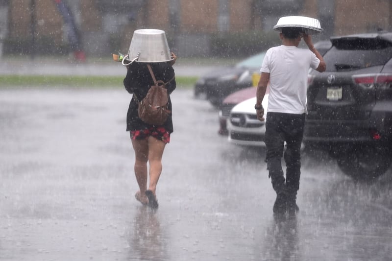
The impacts of such a strong El Niño are expected to be significant across the United States and worldwide. Scientists predict a 63 percent chance it will become a “very strong” event between November 2026 and January 2027, which would rank among the largest in the historical record. A strong El Niño typically brings wetter and cooler than normal conditions across the southern United States during winter, from central California to Florida and up the East Coast. The southern tier of the U.S., including the Gulf Coast region, faces increased chances for more rainfall and severe weather during winter months.
For the northern United States and Canada, El Niño generally favors warmer than average winter conditions. The jet stream over the North Pacific tends to shift southward during El Niño winters, bringing the storm track farther south and redirecting moisture patterns across the continent. This repositioning leads to increased clouds, rain, and severe weather across the south while creating drier conditions over the Northern Rockies and Ohio Valley.
One potential positive aspect of the strengthening El Niño is its dampening effect on Atlantic hurricane season activity. El Niño naturally suppresses Atlantic hurricane formation by creating unfavorable wind conditions in the Atlantic Basin. Forecasters have already reduced predictions for the 2026 Atlantic hurricane season, expecting below-normal activity, while the eastern Pacific may see more tropical activity.

A very strong El Niño can have profound global consequences. The 1997-1998 El Niño, considered one of the most powerful on record, resulted in widespread droughts, flooding, and weather disasters across the globe. The World Bank estimated that event led to 23,000 deaths in weather disasters, increased poverty rates in some countries, and cost governments as much as $45 billion. Economic analyses suggest the global economic impact from that El Niño and the 2015-16 event may have run into the trillions of dollars when accounting for delayed economic responses.
Scientists are concerned about the unusual timing and strength of this developing El Niño. The transition from the previous weak-to-moderate La Niña to what is now emerging as a strong-to-very-strong El Niño within a single calendar year is exceptionally rare, occurring far less frequently than typical climate patterns would suggest. Researchers attribute this rapid shift partly to climate change warming the planet, which may be making such dramatic swings between opposite climate states more common.
Global temperature impacts are also a major concern. The last strong El Niño in 2023-2024 contributed to 2024 becoming the warmest year on record. Many climate scientists are predicting that 2027, benefiting from the accumulated heat being released by the tropical Pacific Ocean during this new El Niño event, will break that record. A UN official warned that El Niño conditions will “pour fuel on the fire of a warming world,” with the potential to increase the risk of heatwaves on both land and marine environments across multiple regions.
While the forecast calls for a very strong El Niño, scientists caution that stronger events do not guarantee stronger impacts. The relationship between the strength of an El Niño and its specific local effects is complex and can vary significantly from one event to another. Every El Niño has its own unique imprint on weather patterns, and the presence of other climate factors and natural variability means outcomes can differ considerably even among events of similar strength. Nevertheless, NOAA officials are urging governments and emergency management agencies worldwide to prepare for potentially significant disruptions to weather, agriculture, and other sectors in the months ahead.