

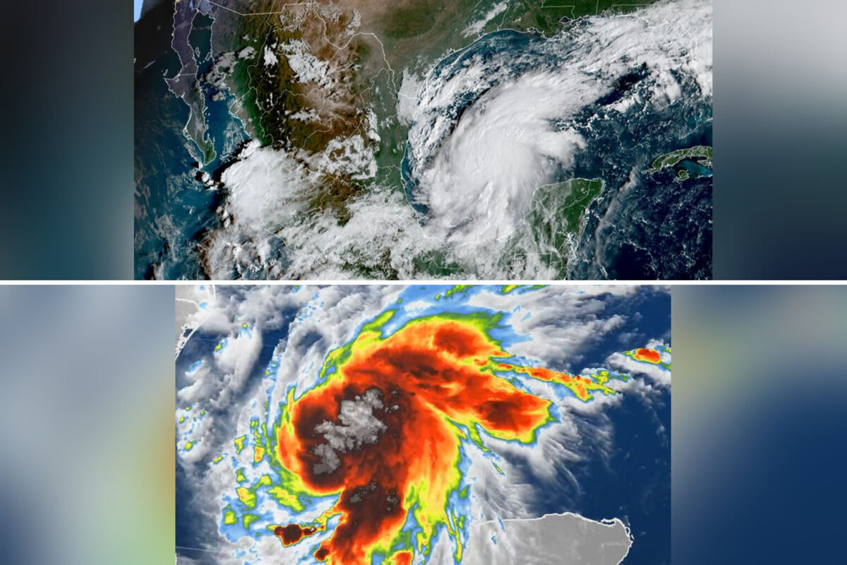
A rare “tale of two coasts” is unfolding this weekend as tropical systems threaten simultaneous impacts on both U.S. Coastlines for the first time in more than 50 years.
Hurricane Isaias, the first hurricane of the 2026 Atlantic season, continues strengthening in the Gulf of Mexico while remnants of Hurricane Rachel push tropical moisture toward California and the Southwest. The concurrent threats could mark only the third such event since 1963.
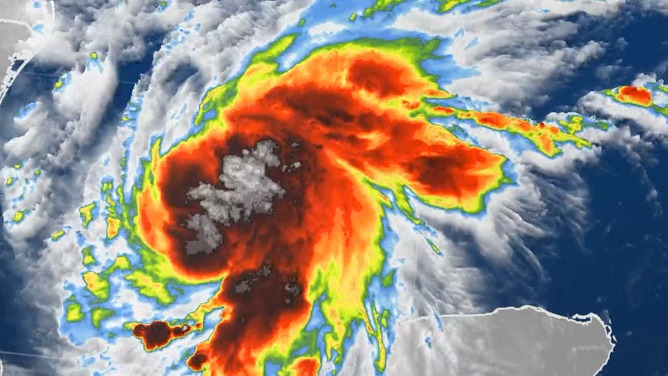
Isaias formed in the Bay of Campeche and is tracking north toward the northern Gulf Coast. The storm is forecast to make landfall late Friday or early Saturday between Gulfport, Mississippi, and Panama City, Florida. Hurricane and Storm Surge Warnings are already in effect for portions of the northern Gulf Coast as the system organizes.
Rain will begin spreading across Gulf Coast areas as early as Friday morning, with rapid acceleration toward land expected later in the day. The storm carries threats of heavy rain, damaging wind gusts, potentially life-threatening storm surge and tornadoes.
The NOAA Weather Prediction Center has issued a flash flood risk for Friday covering Louisiana, Mississippi, Alabama, Florida and Georgia, plus southern Tennessee, southwestern North Carolina and western South Carolina. Mobile, Alabama, and the Florida Panhandle west of Panama City face a Level 3 out of 4 flash flood risk. Atlanta and Montgomery, Alabama, sit under a Level 2 risk before the threat shifts inland Saturday toward the Carolinas and Tennessee Valley.
The NOAA Storm Prediction Center also issued a Level 2 out of 5 severe weather risk for Saturday across southern Alabama and the Florida Panhandle, with tornadoes among the primary threats as Isaias’ outer bands come ashore.
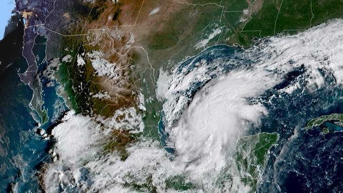
Meanwhile, Rachel’s remnants are expected to trigger heavy rain and flooding across California and the Southwest. The two systems are not projected to directly interact, but their simultaneous impacts create an unusual meteorological scenario.
The last time both coasts faced tropical impacts simultaneously was September 6, 1972, when Tropical Depression Dawn affected the Atlantic side while Post-Tropical Hyacinth hit the West. A similar setup occurred September 18, 1963, when Tropical Storm Cindy struck the Atlantic side while Tropical Depression Jen-Kath impacted the Pacific side.
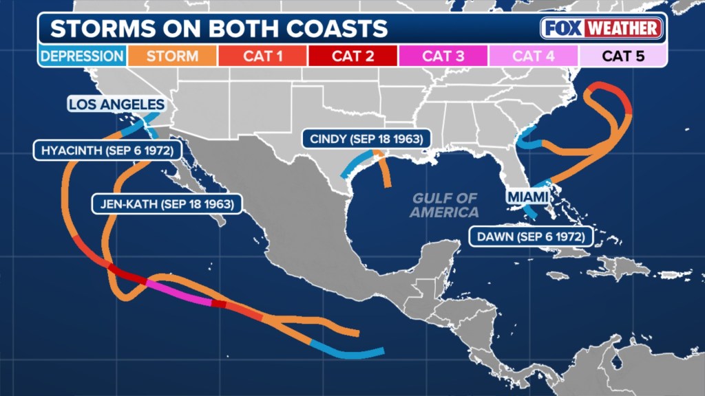
Now more than five decades after the 1972 event, forecasters are monitoring another potential dual-coast tropical episode. The rarity of such setups reflects both the infrequency of West Coast tropical moisture surges and the precise timing required for Atlantic and Pacific systems to affect the continental U.S. Concurrently.
The unusual pattern highlights how tropical activity, even from decaying systems, can extend far beyond typical coastal zones when atmospheric conditions align.
Isaias’ landfall window late Friday or early Saturday will determine whether the dual impacts fully materialize, with Rachel’s moisture already pushing into the West as the weekend begins.