

A climate scientist has warned that this year’s El Niño event could rank as the most powerful in a millennium if current projections hold.
Zeke Hausfather, a climate scientist writing for The Climate Brink, made the stark assessment as new satellite imagery revealed rapidly expanding warm water zones across the Pacific Ocean. “I think that this year’s El Niño event is likely to be the strongest in 1,000 years if the latest models of its peak prove accurate,” he wrote.
The World Meteorological Organization has already projected that the event will strengthen through the remainder of 2026, intensifying extreme weather patterns across much of the planet. El Niño occurs when east-to-west trade winds weaken or reverse, allowing warm surface water to accumulate along the Americas and triggering cascading disruptions to global climate systems.
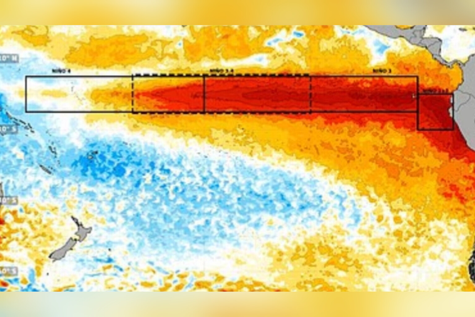
Fresh images from Peru’s national weather service document the alarming pace of oceanic heating. A map captured on 30 September showed concentrated warm water near the coasts of Ecuador and Peru. Just two weeks later, an image from 14 October revealed the heat plume pushing significantly further south toward Chile, with some Pacific regions now exceeding normal temperatures by more than 3°C.
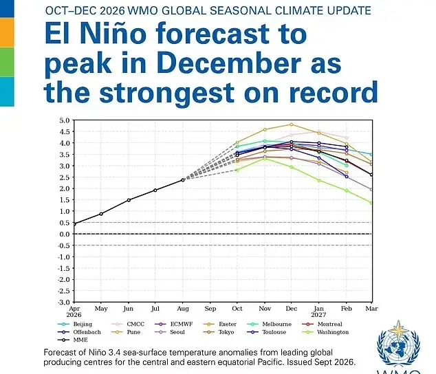
Since 1950, only a handful of comparable El Niño episodes have been recorded, making the current event’s potential scale particularly notable. The phenomenon typically generates severe rainfall in some regions while producing devastating drought conditions in others, with impacts rippling through agricultural systems, water supplies, and storm patterns worldwide.
British residents experiencing unseasonable warmth this month should not single out El Niño as the primary cause, according to Met Office spokesperson Stephen Dixon. “October has started warmer than average for the time of year, but not in a historically significant way,” he said.
Dixon noted that temperatures had reached the low 20s Celsius while the monthly average daily maximum stands at 13.1°C, though he emphasized such readings fall within natural variability. “We’ve reached into the low 20s Celsius today while the average daily maximum temperature for this month is 13.1C,” he said.
The spokesman pointed to a milder air mass positioned over southern UK territory as the immediate driver of current conditions. “The temperatures at the moment are largely down to a milder air mass over southern parts of the UK, helping to keep temperatures above average for the time of year,” he added.
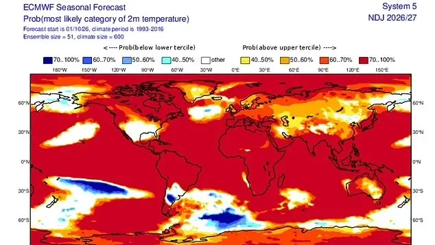
El Niño does figure among several large-scale atmospheric forces shaping UK and European weather patterns, Dixon acknowledged, though its influence remains one factor among many. “El Nino is one of a number of large-scale atmospheric drivers that influence weather patterns in the UK and Europe,” he said.
Looking ahead, the Met Office outlined a mixed seasonal outlook tied partly to the Pacific warming. “However, other atmospheric and oceanic factors will continue to play an important role in determining conditions over the coming months. It could lead to more wet and stormier conditions later in autumn and early winter, while it could also bring drier, cooler and more settled conditions later in the winter,” Dixon continued.
He cautioned against attributing any single domestic weather event solely to the distant oceanic phenomenon. “However, no single weather event in the UK can be attributed to El Nino alone and much will depend on its interaction with other climate drivers,” he added.
The rapid southward expansion of Pacific warm water documented in Peru’s imagery has intensified scientific monitoring of what may become a defining climate event of the decade, with implications for disaster preparedness, agricultural planning, and international climate response coordination stretching into 2027.