Following a series of wildfires that wreaked havoc in Southern California earlier this year, research has indicated that certain regions of the US are more susceptible to such disasters.
Recent events have shown an increase in the frequency of these fires, with August continuing to be the most active month for these occurrences.
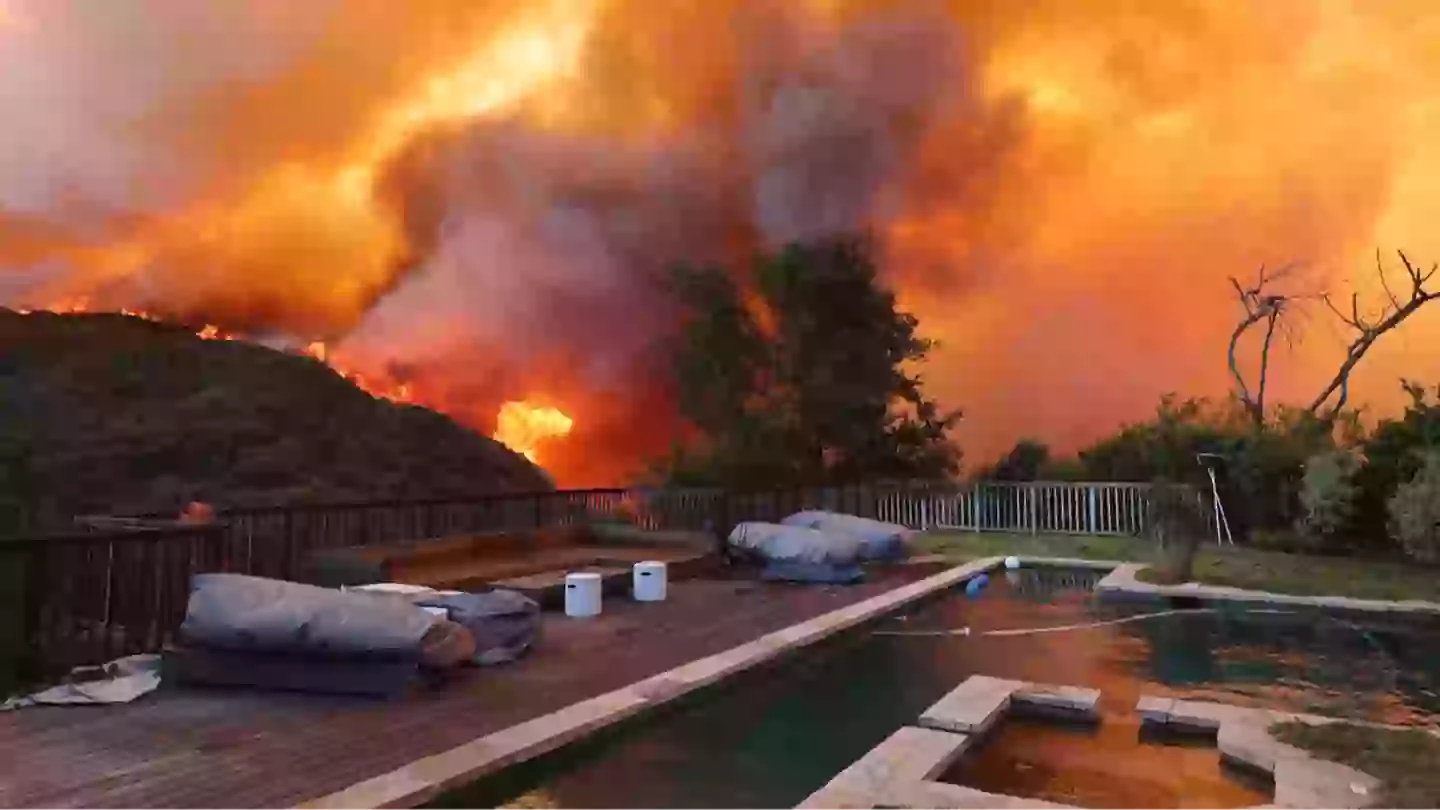
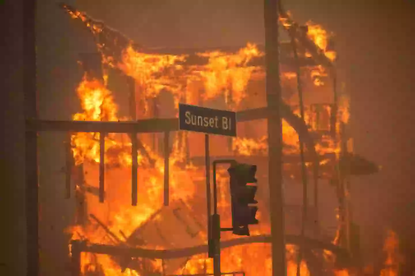
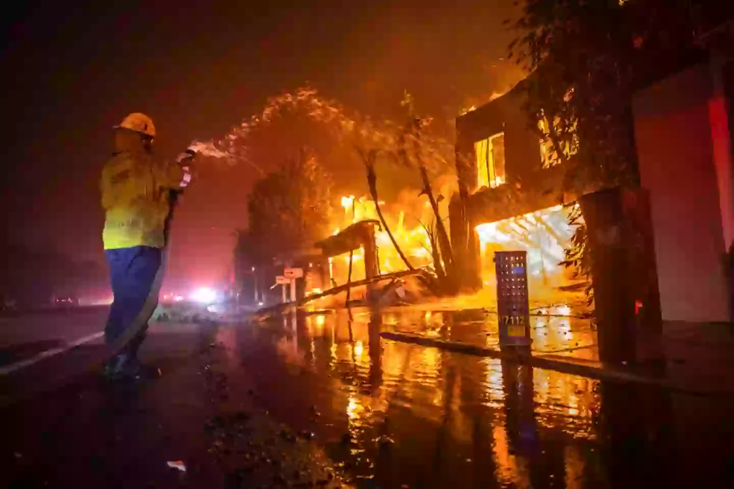
At the start of 2025, vast portions of California were ravaged by fires, leading to the deaths of 30 individuals and displacing over 200,000 people.
The wildfires in California were not an isolated event, as New Jersey also experienced a significant fire, resulting in dangerous air quality conditions throughout the state and extending into New York.
Research released earlier this week by AccuWeather presents a daunting forecast, predicting that between 7 and 9 million acres could be consumed by fires across the United States, surpassing the historical average of 7 million.
This year, it is estimated that there will be between 60,000 and 75,000 fires nationwide, with California alone expecting 7,500 to 9,000 incidents.
The research also sheds light on why spring fires are becoming increasingly problematic. Although summer and autumn are traditionally more affected by fires, drought conditions might lead to fires striking some areas even in spring.
In reaction to this crisis, AccuWeather has developed a map highlighting US regions at elevated fire risk, particularly focusing on the Southern Plains and interior Southwest.
“Despite a few early spring storms, drought conditions remain deeply entrenched,” stated senior meteorologist Paul Pastelok.
“Dry, windy and low-humidity days are expected to be frequent across the region, leading to rapid drying of available fuels and an increased number of high-risk wildfire days.”
Pastelok also noted: “While the season may start slowly, there is strong potential for rapid escalation as drought conditions and heat set in.”
While the fire threat has decreased in regions like eastern Texas, Arkansas, and southeastern Oklahoma, there’s still a possibility of additional fires igniting throughout the rest of spring.
The summer months could bring a rise in wildfire activity due to changing weather conditions, particularly in the Northwest and northern Rockies.
“While the season may start slowly, there is strong potential for rapid escalation as drought conditions and heat set in,” reiterated Pastelok.
High risk persists for Southwestern states during early summer monsoon rains, especially when lightning from the storms hits parched landscapes, sparking fires.
As the monsoon season progresses, rains might help mitigate fire risks, explained AccuWeather Meteorologist Brandon Buckingham.
“As summer progresses, repeated rounds of monsoon rains and elevated humidity should help suppress wildfire development, particularly in Arizona, western New Mexico and southern Utah,” stated Buckingham.
Other areas should remain vigilant as well, according to Buckingham.
“Dry stretches with below-normal thunderstorm activity can lead to temporary flare-ups, especially in the Carolinas, parts of Georgia, Florida and the Gulf Coast,” he said.
Additionally, the fallen trees from a late-March ice storm could temporarily heighten the fire risk in northern Michigan and northeastern Wisconsin during the summer and fall.