

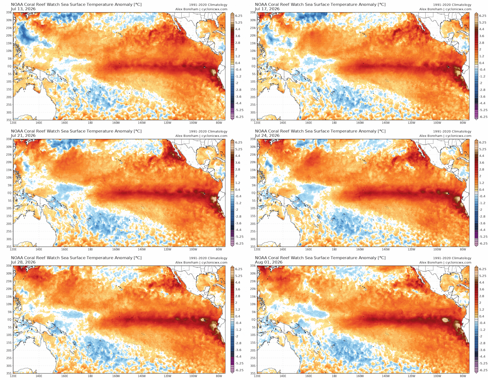
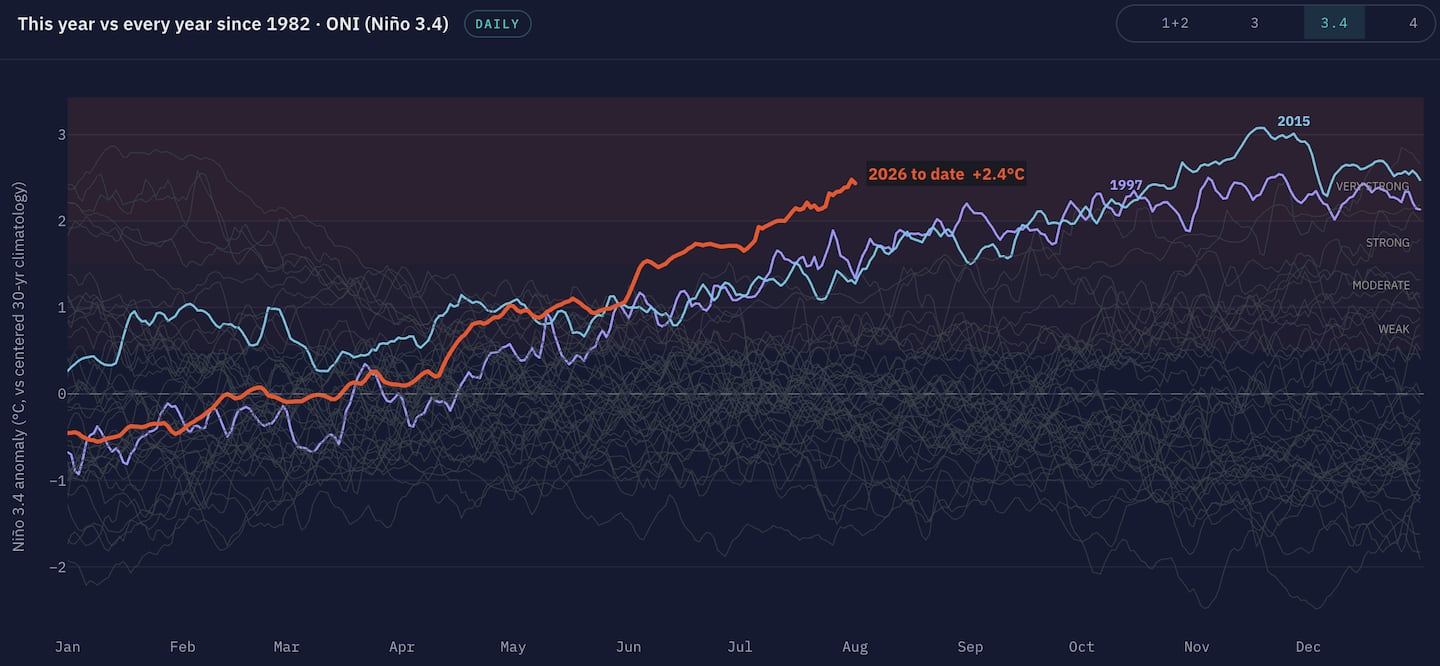
A developing El Niño climate pattern is forecast to strengthen significantly during the second half of 2026, with some forecasters warning it could evolve into a rare “super” El Niño and potentially rank among the strongest events on record, as NOAA says El Niño conditions are already established in the tropical Pacific and are expected to intensify through the end of the year.
Watch on TikTok
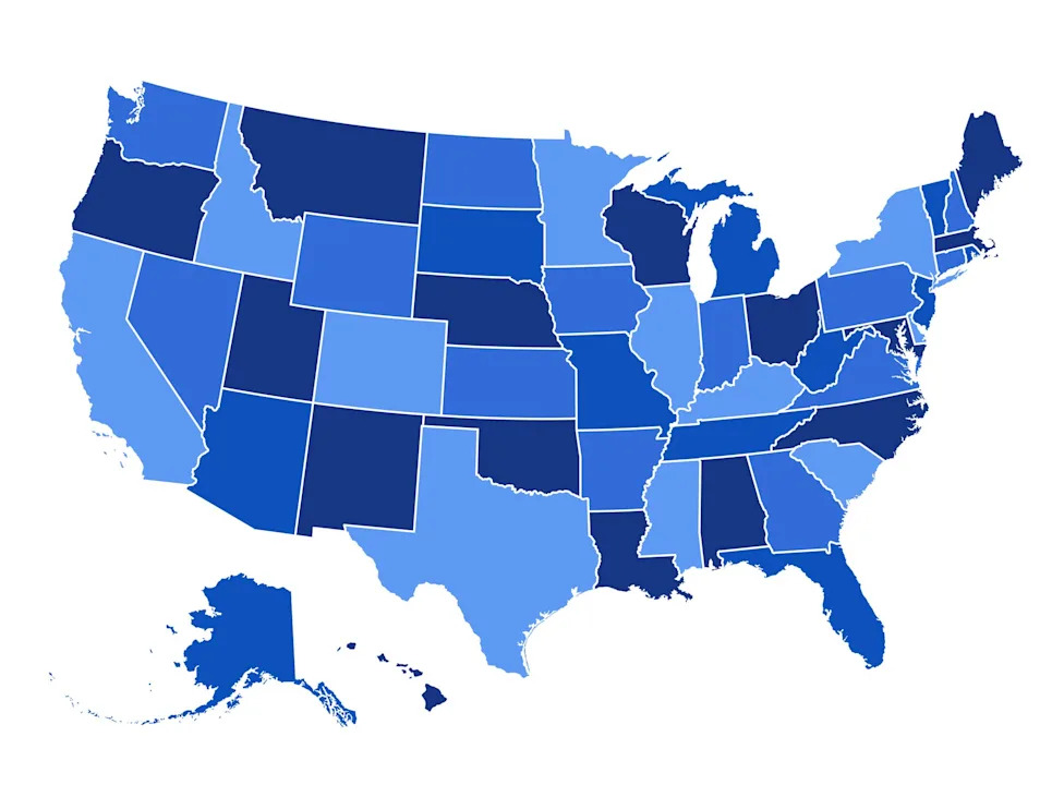
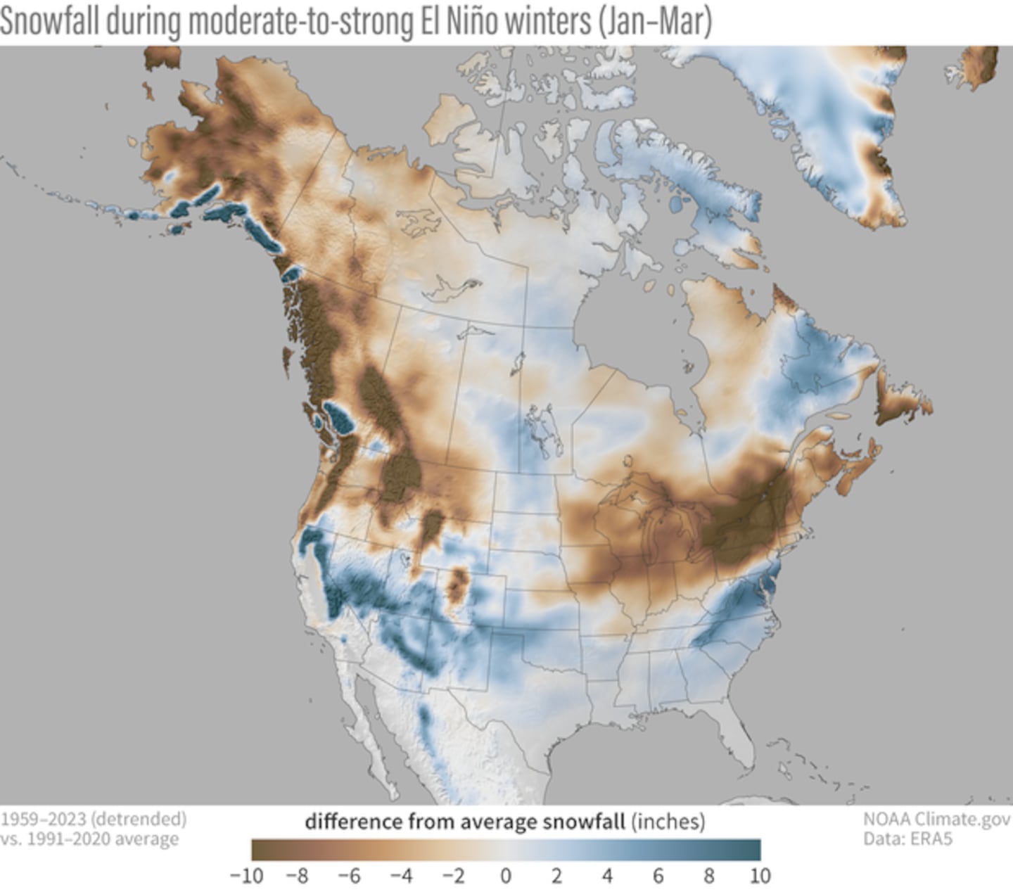
California in the Sierra Mountain range, New Hampshire, New York and Vermont are all expected to see heavy rain and significant snow, according to the latest predictions.
AccuWeather Lead Long-Range Forecaster Paul Pastelok said that California’s central Sierra Nevada can “get a lot more snow” during strong El Niño events, and that New York, Vermont, and New Hampshire face heavy rain and significant snow.
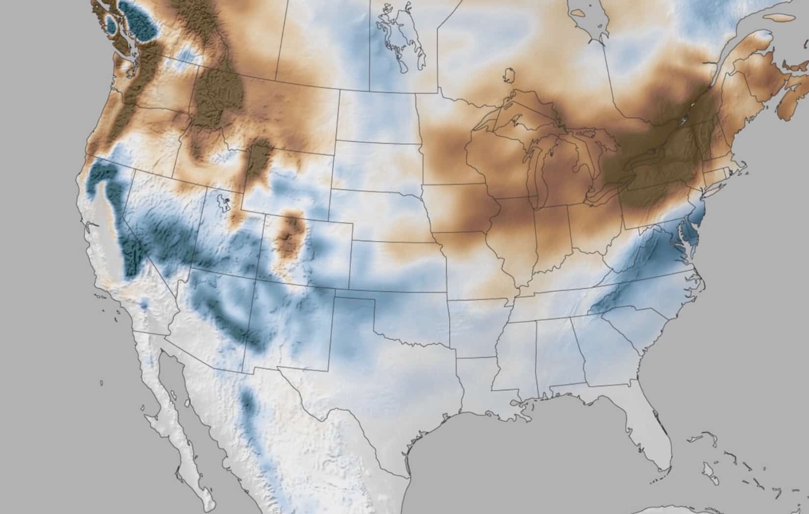
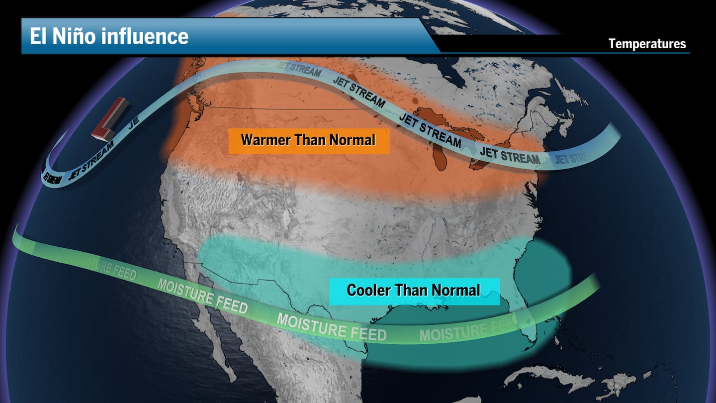
El Niño is expected to remain an important influence through the heart of the season, favoring wetter-than-normal conditions across much of the southern United States, with an active storm track extending from Southern California and the Desert Southwest through Texas, the Gulf Coast, and the Southeast.
Forecasters are warning that a strengthening El Niño climate pattern could turn the southern United States into a “storm highway” during the coming winter, increasing the risk of both extreme rainfall and severe thunderstorms.
The southern Rockies may fare especially well for mountain snowfall.
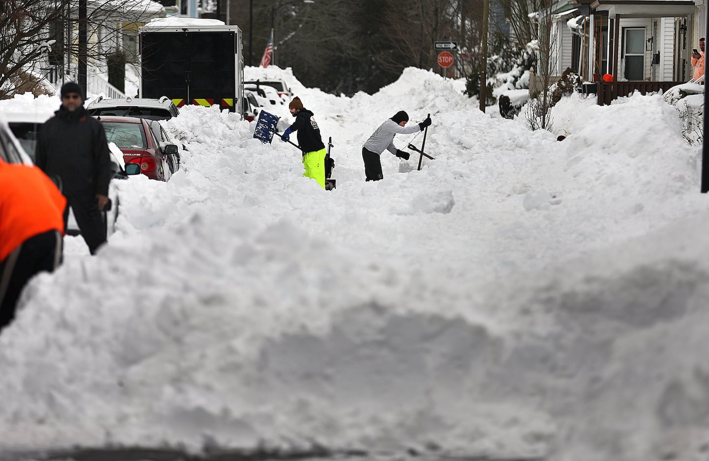
In New England, forecasters suggest residents may be laying rock salt and using umbrellas more than shovels this winter, as snow will still fall but the periods of mild weather will likely last longer, and more winter storms will produce rain instead of snow, especially along the I-95 corridor across New England.
Johnna Infanti, a meteorologist at NOAA’s Climate Prediction Center, said: “Currently, we are predicting above-normal precipitation during the fall and winter seasons over much of the Southern U.S., with the highest probabilities for above-normal precipitation over the Gulf States and parts of the Southeast to Mid-Atlantic, indicating the areas where we have the most confidence.”
NOAA predicts strong El Niño conditions will peak this winter.
Ken Graham, director of NOAA’s National Weather Service, said “Every El Nino is not the same; each one is unique with its own imprint on our weather.”
When colder air meets abundant moisture, some storms could produce sleet, freezing rain, or heavy, wet snow.
Dan Cayan, a researcher at Scripps Institution of Oceanography, said “Large El Niños tend to tilt the odds toward more winter north Pacific storms and also larger ones, because of the energy imparted to the atmosphere from the ocean.”
Strong El Niño winters have a record of reshaping Southern California beaches, scouring some and burying others, though for every break that turns on, there is an eroded beach and the occasional day when the swell is simply too big and disorganized to ride.
California is often one of the most closely watched states during major El Niño events because a stronger Pacific jet stream can steer powerful winter storms into the region, raising the risk of heavy rainfall, flooding and mountain snow in the Sierra Nevada.
Forecasters predict a 63% chance of sea surface temperatures exceeding 2.0°C in the Nino-monitored region of the Pacific, and if this threshold is surpassed, NOAA considers the event a “very strong” El Nino.
The super El Niño is forecasted for fall to winter 2026-2027.
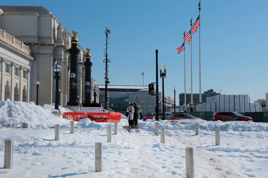
A warmer winter could suppress the amount of snowfall for the interior Northeast, but it can also set the stage for major coastal storms and statistically, large snowstorms are more likely during El Niño winters, with fewer small snow events but one or two massive nor’easters that provide most of the season’s total snowfall.
Under strong El Niño conditions, the track often stretches from California through the southern Plains and toward the Gulf and Atlantic coasts.
A wet El Niño unleashed complex chain reactions across American landscapes.
In previous cycles in the last century, the El Niño circulation pattern drove storms that dumped copious rain on Southern California, with San Diego having 70 wet days in 1982-83, compared to 40 to 45 in a normal year, or more than one-and-a-half times the usual storm days.
Major El Niño events can raise local sea level by around 6-10 inches in California during the winter rainy and stormy season through a combination of northward-propagating coastally-trapped Kelvin waves and thermal expansion of seawater.
The El Niño is expected to strengthen through the end of the year, with a 97% chance it will last through early spring 2027.