A Super El Niño could develop any time between now and August — and if it does, some parts of the world may face serious knock-on effects.
The phrase has been appearing more and more lately as scientists track conditions in the Pacific. El Niño is a recurring climate pattern that typically shows up every two to seven years and often lasts around nine months.
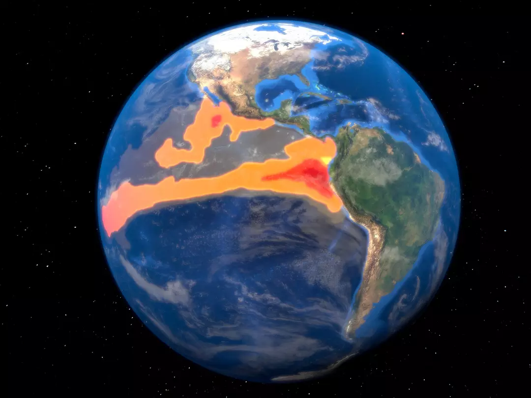
It begins when sea-surface temperatures across the central and eastern Pacific rise above normal levels, which can disrupt winds and shift weather patterns far beyond the ocean itself.
A Super El Niño is essentially a stronger version. According to NOAA, the label applies when Pacific waters climb to about 3.6 degrees Fahrenheit above the long-term average.
NOAA says the odds of an El Niño forming in July 2026 are above 80 percent, though the shift could arrive earlier than that.
And if it ramps up quickly, there are signals that may hint it’s accelerating.
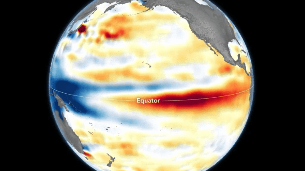
Recent imagery highlighting a broad pool of unusually warm water off the South American coastline has drawn attention, with some suggesting it could be the kind of extreme setup that fuels a powerful El Niño.
NASA, alongside the European Space Agency (ESA), has shared satellite images captured by Sentinel-6 Michael Freillish that show conditions consistent with El Niño activity.
Below are some of the main impacts experts say could unfold in a worst-case scenario:
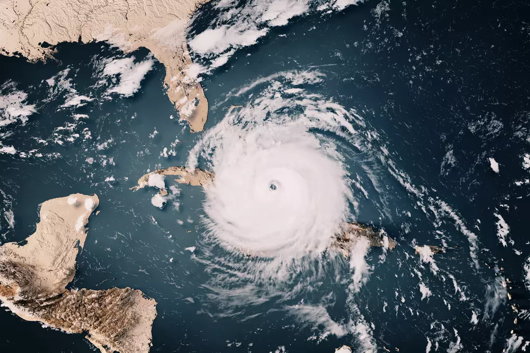
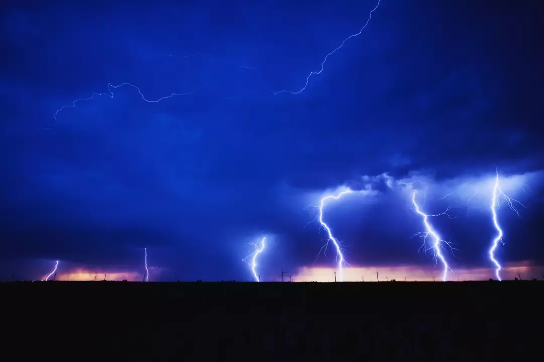
Increased hurricane activity
Because warmer ocean temperatures can reshape atmospheric conditions, hurricane season in both the Atlantic and Pacific may become more active than usual.
The timing would align with the current seasonal window, and AccuWeather has warned that 2026 “could be an unusually active and potentially impactful year in the Pacific basin” — forecasting roughly 17 to 22 named storms, nine to 13 hurricanes, and four to eight major hurricanes.

Drought
Several parts of the Northwest are already dealing with drought conditions. The U.S. Drought Monitor lists areas such as southwestern Idaho, along with Nevada, Utah, and Colorado, among those being hit hardest.
Less rainfall combined with higher temperatures can be especially damaging in regions that rely on seasonal precipitation to replenish water supplies and support agriculture and livestock.
“The stretches of dry weather can lead to a prolonged moderate to severe drought from the I-81 corridor in the Mid-Atlantic into the Southeast,” AccuWeather meteorologist Chad Merrill told NewsWeek. “Since the rain may come in large quantities over a short time period, there may not be much percolation into the soil to help the agricultural communities.”
That type of drying trend can also set the stage for further climate-related hazards.
When landscapes become drier than normal across parts of the US, another risk tends to rise with it: wildfires.
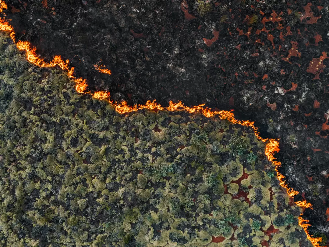
Wildfires
“For the summer, a consequence of El Niño will be a hotter and drier pattern in the Northwest U.S. that can lead to large wildfires,” said Merrill. “Additionally, severe drought can expand across more of the Northwest into the northern part of the Rockies during El Niño summers that transition to a strong to very strong El Niño by the fall to early winter.”
But while some locations may dry out, other areas could swing in the opposite direction.
Thunderstorms
Hotter conditions can sometimes be followed by intense bursts of rainfall — and during an El Niño, those shifts can become more volatile than a typical summer storm pattern.
Merrill said El Niño conditions could combine with a marine heat wave off the West Coast, potentially increasing thunderstorm activity beyond what the region usually sees.
He added that storms may initially arrive as dry thunderstorms in mid to late June, which can ignite fires, and later in the season transition into storms capable of triggering flash flooding.
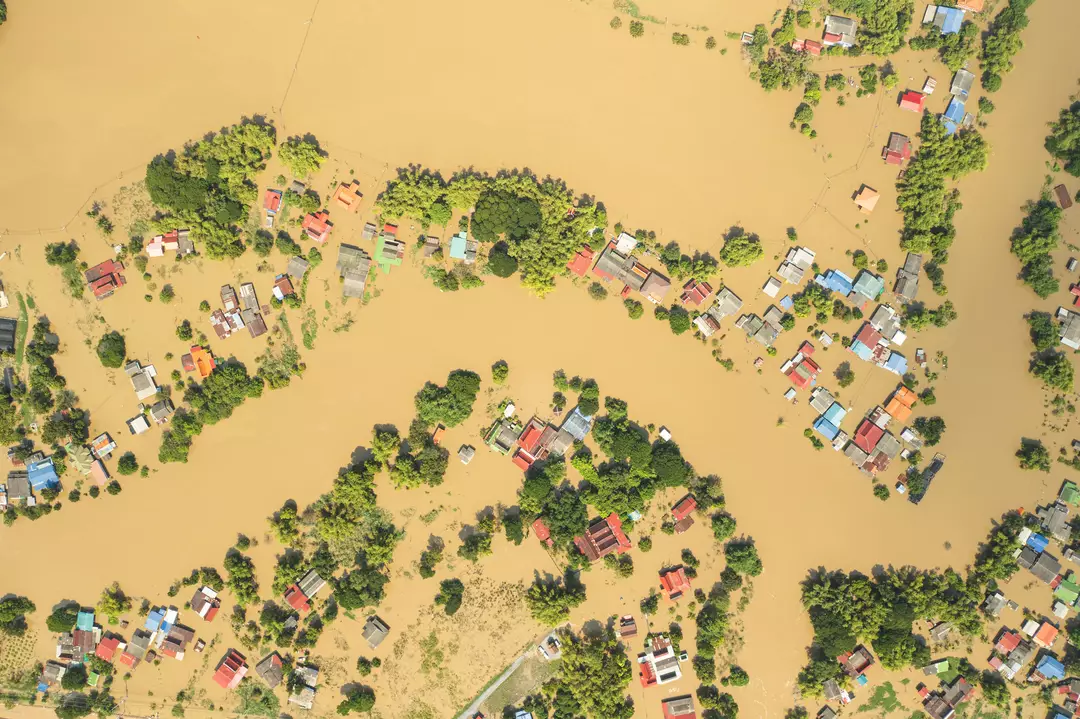
Flash floods
Merrill also warned that flash flooding can become more likely when heavy rain follows a long dry spell, with late July and August highlighted as a period when impacts could be felt in places such as the West Coast and Southern California.
“A heightened East Pacific hurricane season combined with the warm water off the West Coast can lead to tropical downpours inundating southern California and the Southwest from mid to late summer into the early fall season. This can lead to the potential of larger-scale flash flooding,” explained Merrill.
He added: “Repeated rounds of heavy rain through much of the summer can lead to flooding problems. This includes northern Texas to southeast Nebraska, Iowa, Illinois, Indiana, Ohio and even western Pennsylvania.”
According to Merrill, the Plains and Midwest could also see episodes of heavy rainfall and the associated risk of flash flooding.