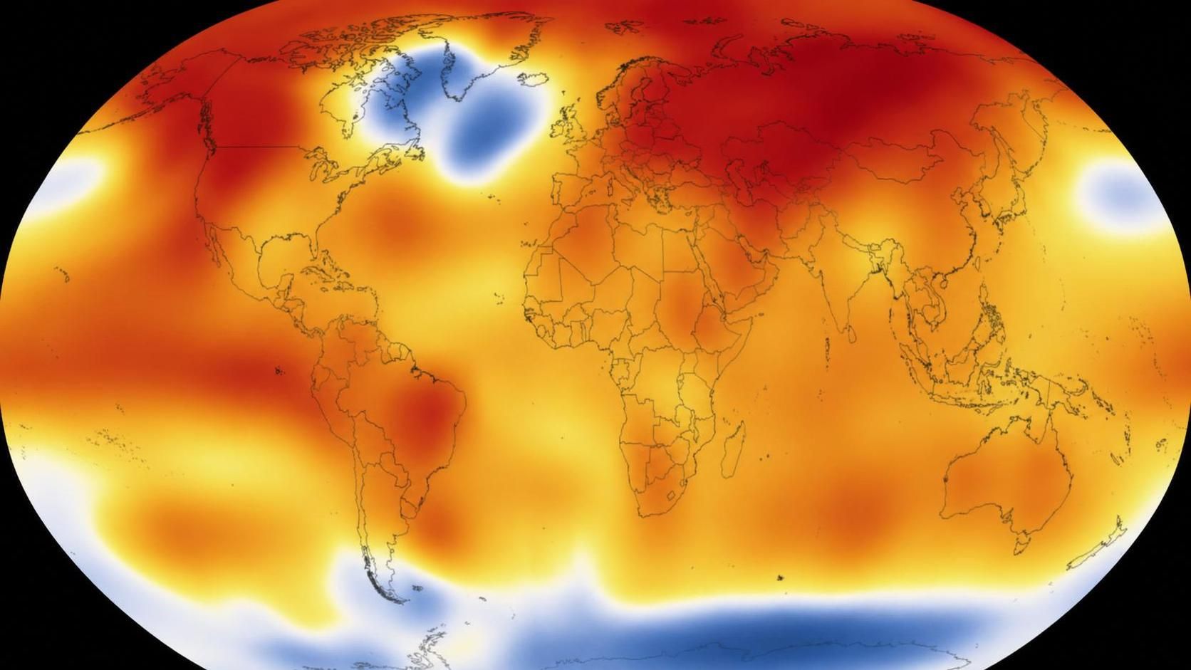
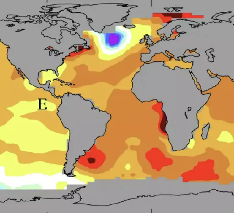
Researchers say a patch of unusually cold water south of Greenland, known as the ‘cold blob’, may have major consequences for weather across the United States.
The area, also referred to by scientists as the ‘warming hole’, sits in the North Atlantic and has remained noticeably cooler than surrounding waters.
For years, the region has stood out because it has not warmed in the same way as many other parts of the world’s oceans.
Now, a study published in Geophysical Research Letters has offered a possible explanation for why the ‘cold blob’ persists, while also warning that it could influence weather systems far beyond Greenland.
According to the research, the cool patch is likely linked to a slowdown in the Atlantic Meridional Overturning Circulation, commonly known as the AMOC.
The AMOC is a major network of ocean currents that helps transfer heat through the Atlantic, playing an important role in regional climate and weather conditions.
Warm water is carried northward near the surface before colder, denser water sinks and travels back south in the deep ocean.
Because of that movement, the system helps balance temperatures across large areas of the Atlantic.
If the AMOC weakens, however, the effects may not be limited to ocean temperatures near Greenland.
Scientists have warned for some time that climate change could disrupt the circulation, especially as melting ice from Greenland adds more freshwater into the North Atlantic.
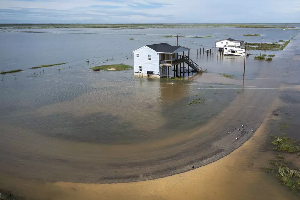
One concern for the US is the potential impact on sea levels along the East Coast.
Experts cited by Live Science have said this has already played a significant role in increasing the risk of coastal flooding along parts of the Northeast coast.
The latest research also connects a weaker AMOC with changes in rainfall across the tropical Atlantic.
Researchers have also suggested that storm tracks around the North Atlantic could be affected if the circulation continues to weaken.
The findings come as forecasters are also watching for the possible return of El Niño later this year, with conditions potentially lasting into 2027.
El Niño begins with trade winds, which are steady winds near the equator that usually move from east to west. In the equatorial Pacific, that means they typically blow from the Americas toward Australia and New Zealand.
As surface water is pushed west, it warms under the sun. By the time it reaches the western Pacific, the warmer water helps hot air rise, creating warm, wet and unsettled conditions. At the same time, cooler water from deeper in the ocean rises in the east to replace the water that has been pushed away.
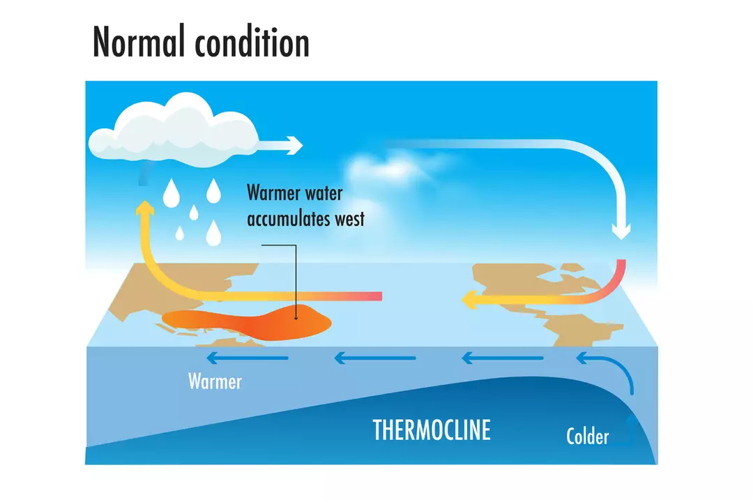
During El Niño, that normal pattern is interrupted.
When trade winds weaken or reverse direction, the usual temperature contrast between the eastern and western Pacific breaks down, allowing parts of the ocean that are normally cooler to become warmer.
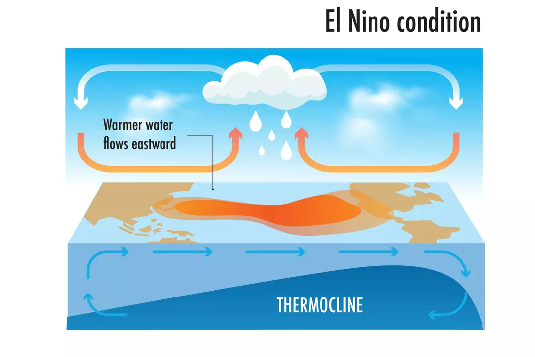
That shift alters wind and rainfall patterns across the equatorial Pacific, with wider effects that can be felt around the globe.
It is a complicated chain of events, but scientists say these ocean changes can have very real consequences for weather on land.