Freshly published NASA observations suggest a key early signal of an El Niño episode, as countries brace for potentially severe weather this summer.
Speculation about a particularly powerful “Godzilla” El Niño has been building for months, but the World Meteorological Organization (WMO) has cautioned that the forecast picture remains uncertain because different models are pointing in different directions.
Celeste Saulo, the secretary general of the WMO, recently said: “There are models that are not providing any indication of a strong El Niño, while others are doing so.”
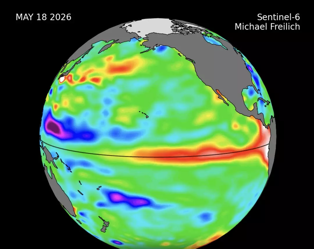
Now, NASA says measurements gathered by the international Sentinel-6 Michael Freilich satellite offer evidence that an El Niño pattern—an event that typically appears every two to seven years—may be developing.
According to a NASA press release, data collected from March through May detected “higher, warmer water” shifting across the Pacific, moving from the western basin toward waters off Colombia, Ecuador, and Peru.
NASA added that the shift reflects a specific ocean process.
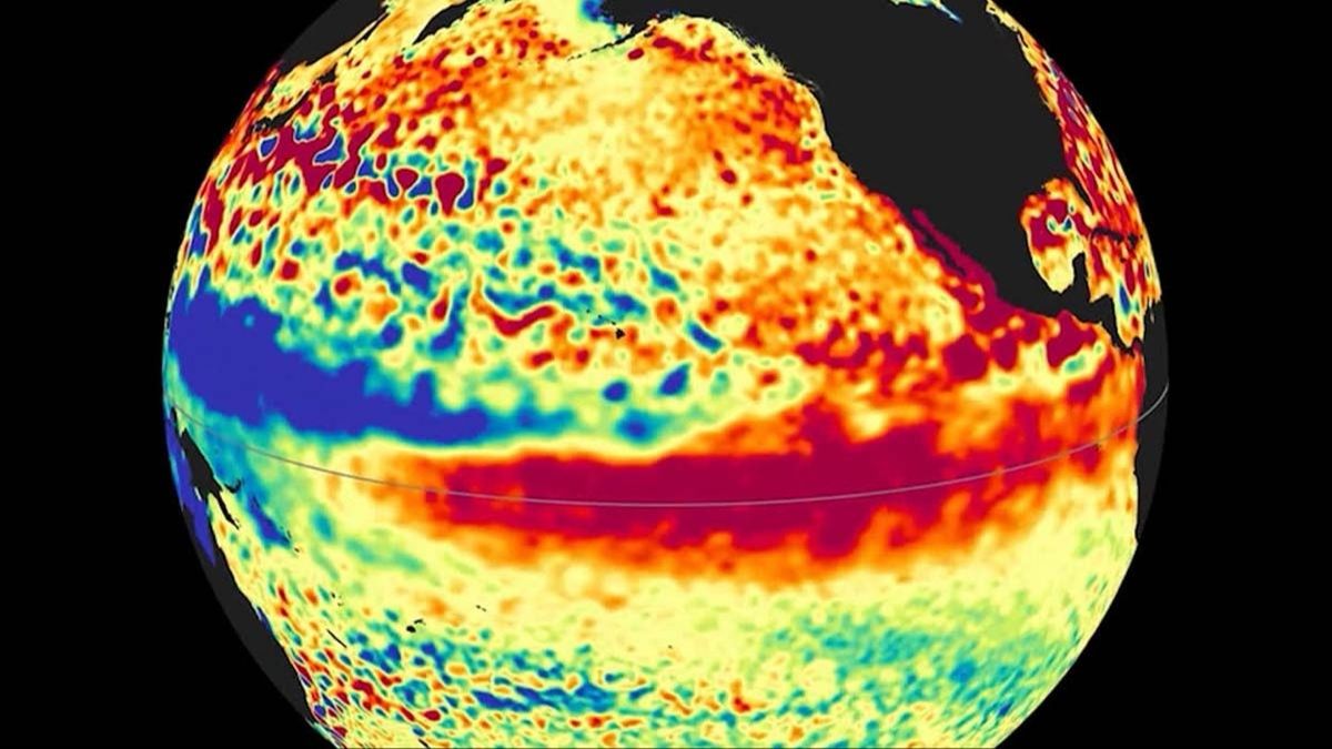
The space agency further explained: “This phenomenon is known as a warm Kelvin wave, signified in this animation of the data by yellow, orange, red, and white.
“The emergence of Kelvin waves in the early part the year is a signal that an El Niño event is likely to follow.”
By mid-May, NASA reported that sea levels near Peru were about 5.9 inches (15cm) above long-term averages—an increase that can be tied to warming water.
NASA said of this: “Because water expands as it warms, a rise in elevation of an area of the ocean indicates increasing temperature.”
El Niño can reshape weather patterns globally. The National Weather Service notes it often brings warmer, drier conditions to parts of North America and Canada, while the US Gulf Coast and Southeast are more likely to see wetter conditions and a higher flood risk.
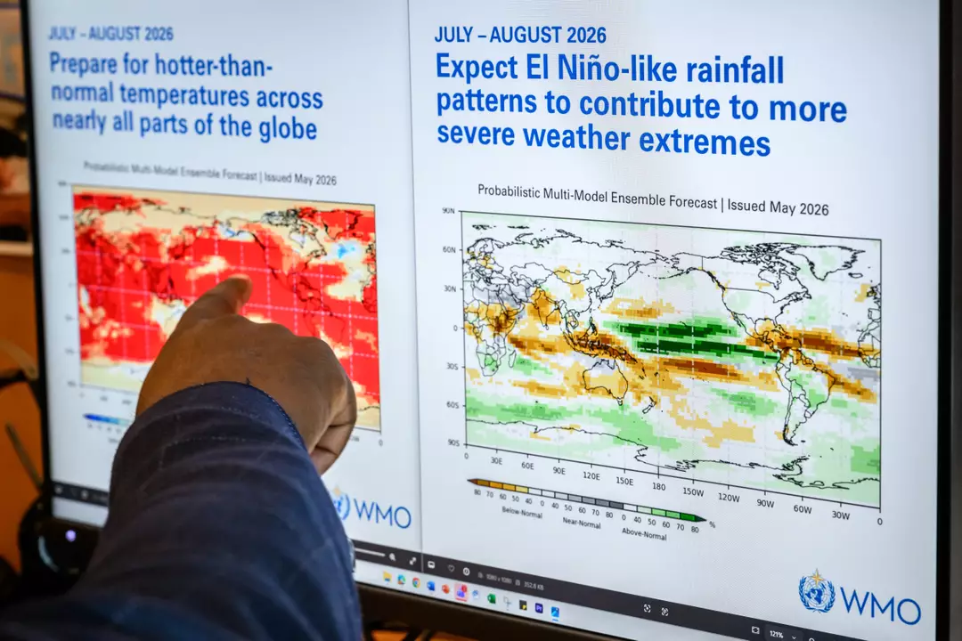
While NASA said El Niño is “likely,” it did not specify exactly when impacts could begin. The WMO, however, has provided probability estimates, saying there is an 80 percent chance the event forms before September and a 90 percent chance before November.
Those projections have also prompted warnings from UN Secretary-General António Guterres, who said the expected conditions should be treated as a serious alarm for the climate.
“The science is clear: El Niño is arriving on our doorstep in the coming months with 90 percent certainty. The world must treat it as the urgent climate warning it is,” he said.
Guterres continued: “El Niño conditions will pour fuel on the fire of a warming world. Impacts will hit even harder, travel even farther, and cross borders with devastating speed.
“The only effective response is climate action equal to the crisis – ending the addiction to fossil fuels, accelerating the shift to renewables, protecting the most vulnerable, and delivering early warning systems for all.”

So what’s actually happening in the ocean-atmosphere system when El Niño forms?
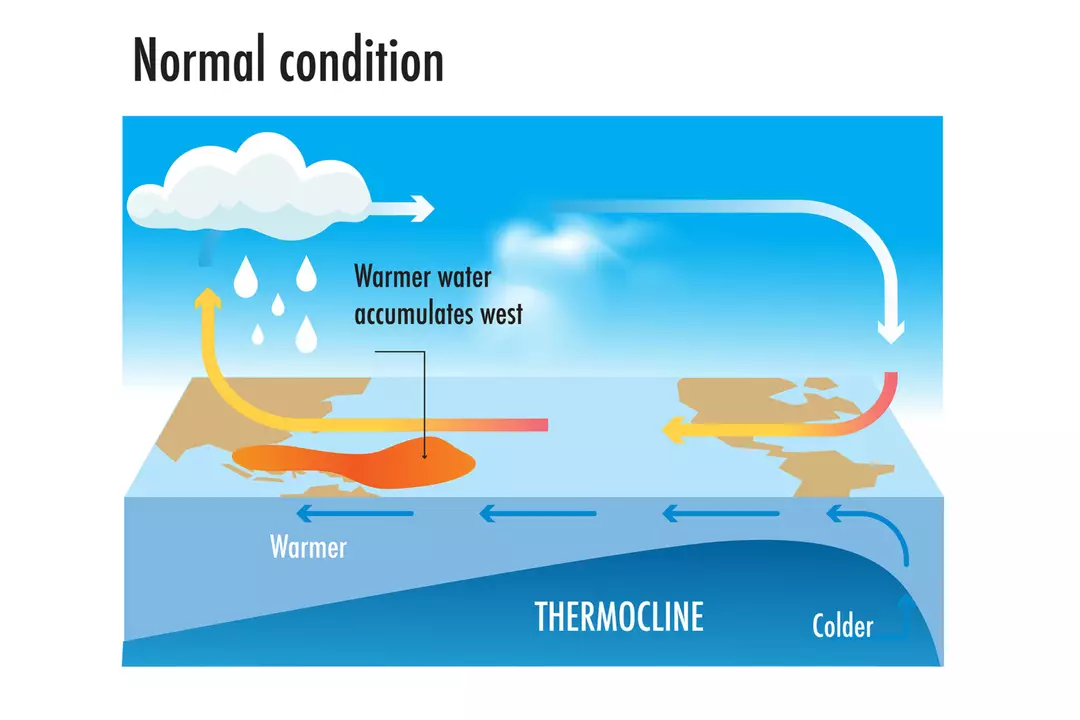
Under normal conditions, trade winds—steady winds near the equator—typically blow from east to west. Across the equatorial Pacific, that means they generally push surface waters from the Americas toward Australia and New Zealand.
As these surface waters move westward, sunlight warms them. Warm water encourages warm air to rise, which helps drive cloudiness, rainfall, and unsettled conditions in the western Pacific. Meanwhile, cooler, nutrient-rich water wells up in the eastern Pacific to replace water that has been pushed away from the coast.
In El Niño years, that usual setup can break down.
If trade winds weaken significantly—or in some cases reverse—the typical east-west contrast fades. The cooler eastern Pacific can warm, and the pattern of rising air and storms shifts away from its usual position.
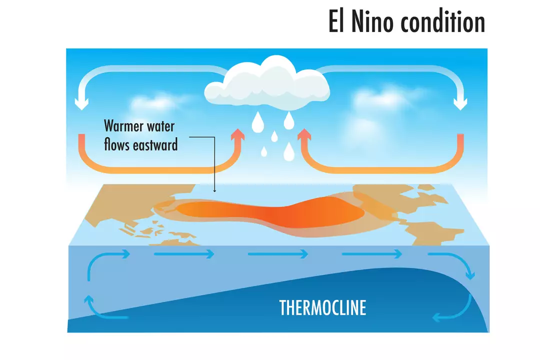
Once rainfall and wind patterns are rearranged across the equatorial Pacific, the effects can ripple outward—altering storm tracks, temperature patterns, and precipitation far beyond the tropics.
If that feels like a lot to take in, you’re not alone.