
Residents of U.S. territories in the western Pacific were bracing Friday for a possible super typhoon, just months after the region was hit by the strongest tropical cyclone on Earth this year. Typhoon Bavi is rapidly intensifying over warm ocean waters east of Guam and is forecast to strike the Mariana Islands as a dangerous Category 4 or Category 5 super typhoon by Monday, bringing damaging winds, storm surge and torrential rainfall to islands still recovering from Super Typhoon Sinlaku’s devastating April strike.
The timing is particularly grim for residents of Saipan and Tinian, where power infrastructure remains only partially restored nearly three months after Sinlaku made landfall on April 14. “We’re getting ready to do this all over again,” said Edwin Propst, a former lawmaker who works in the governor’s office on Saipan. “The timing is terrible.”
Sinlaku, which reached peak winds of 185 miles per hour, struck the Northern Mariana Islands and Guam as the most powerful tropical cyclone to develop worldwide in 2026. The storm lingered for more than two days over the islands due to its slow forward movement, pounding Saipan and Tinian with ferocious winds, relentless rain, and severe flooding. Widespread power outages affected tens of thousands of residents, and the storm caused catastrophic damage to homes and infrastructure. By early 2026 estimates, damages exceeded one billion dollars.
The recovery has been slow and grinding. One week after Sinlaku made landfall, most residents on Saipan still lacked power or running water. By late June, about two and a half months after the storm, roughly half of Saipan’s utility customers had regained power from the grid, though generation capacity had been restored to exceed pre-storm levels. The lag was primarily due to widespread damage to distribution infrastructure, including downed power poles and damaged lateral lines throughout the villages. Water production recovered to about 92 percent of normal capacity, but boil water notices remained in effect across the islands.
On Tinian, power restoration proved even more challenging, with the entire power supply offline after Sinlaku. By June, only 65 percent of customers had been restored to service. The smaller island of Rota saw faster recovery, with most power restored and minimal customers still without electricity by mid-May.
The federal government mobilized significant resources for recovery. The U.S. Army Corps of Engineers deployed personnel and equipment, installing emergency generators and collecting over 55,000 cubic yards of debris. Federal Emergency Management Agency approved roughly $48 million in disaster assistance by mid-June, while the Small Business Administration distributed over $19 million in loans across roughly 1,000 applicants. Hundreds of American Red Cross disaster workers remained deployed on the islands throughout May and June, assisting residents as they rebuilt.
Temporary shelter became a critical need. The Sustainment of Temporary Resilience and Operational Needs on Ground, or S.T.R.O.N.G., tent and roofing mission completed 1,424 tent installations and 979 temporary roof installations across Saipan, Tinian and Rota in the months following the storm, providing housing for residents whose homes were destroyed or damaged.
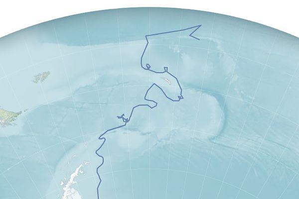
Now, with Typhoon Bavi approaching, forecasters warned of potentially catastrophic impacts. Bavi was centered about 760 miles east of Guam on Friday, moving westward at 10 to 15 miles per hour. The storm is expected to reach super typhoon status by Sunday morning, with some forecasts suggesting it could intensify to a Category 5 storm by the time it passes through the island chain on Monday. Forecasters projected winds of at least 150 miles per hour, with a potential for even stronger conditions.
The projected track of Bavi closely resembles that of Sinlaku, though meteorologists noted one key difference: Bavi is expected to move through the islands more quickly rather than lingering. Saipan International Airport recorded gusts exceeding 130 miles per hour during Sinlaku; residents worried similar or worse impacts could occur with Bavi.
Forecasters warned of dangerous flash flooding and landslides. Rainfall could reach four to five inches within a single hour, creating conditions likely to trigger dangerous flash flooding in hilly or mountainous terrain. Confidence in the exact track remained moderate; even a slight shift southward could bring the storm closer to Guam, increasing threats to the largest and most populous island.
A National Weather Service meteorologist described the forecast as “grim” and cautioned that while the track had held relatively steady near Tinian, wobbles should be expected with each new forecast issued every six hours. “We could be facing a super typhoon somewhere within the Mariana Islands Monday, and this could be a direct hit to any one of our populated islands from Guam to Saipan,” the meteorologist said.

On Guam and the Northern Mariana Islands, residents were in the midst of mandatory storm preparations. Officials urged all preparations to be completed by Saturday afternoon as conditions were expected to deteriorate rapidly Sunday. Power utility officials warned of potential outages and advised residents to secure loose outdoor items and stock essential supplies.
Residents expressed a grim determination mixed with concern. Some were hoping Guam would take the worst of the storm to allow their neighbors in the Northern Marianas additional time to continue recovery from Sinlaku. Church leaders and residents who had weathered numerous typhoons over their lifetimes said they remained hopeful storm patterns could shift, though they acknowledged such hopes were uncertain.
The combination of a region only partially recovered from a devastating storm and the approach of another powerful typhoon highlighted the vulnerability of the remote Pacific island territories. The islands are typically affected by tropical storms or typhoons six to seven times annually, with typhoon season typically running from June through December. The year 2026 had proven particularly active, with meteorologists noting it would be the most active Pacific typhoon season by mid-year since 1976.