
Hurricane Erin has intensified from a tropical storm to a category five hurricane, prompting significant alerts across seven US states and neighboring countries as it alters its course.
The hurricane was last reported moving northwest at 13 mph with maximum sustained winds of 100 mph. There remains potential for it to strengthen further.
Erin reached category five status on August 16 but was later downgraded to category three. Nonetheless, it is predicted to cause significant damage, as indicated by NBC News.
The hurricane’s forceful winds are projected to extend up to 90 miles from its center, with tropical-storm-force winds reaching up to 265 miles.
Being the first hurricane of the Atlantic season, Erin appears to be a formidable one.
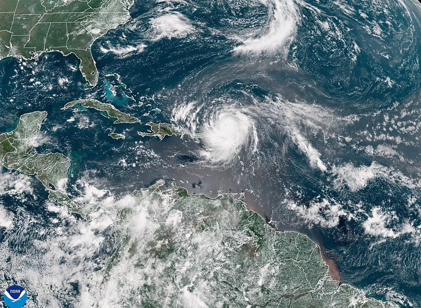
Various mapping organizations and websites are closely tracking Erin’s movements.
The hurricane’s trajectory is now trending westward compared to earlier forecasts, and although landfall is not currently anticipated, it remains a possibility.
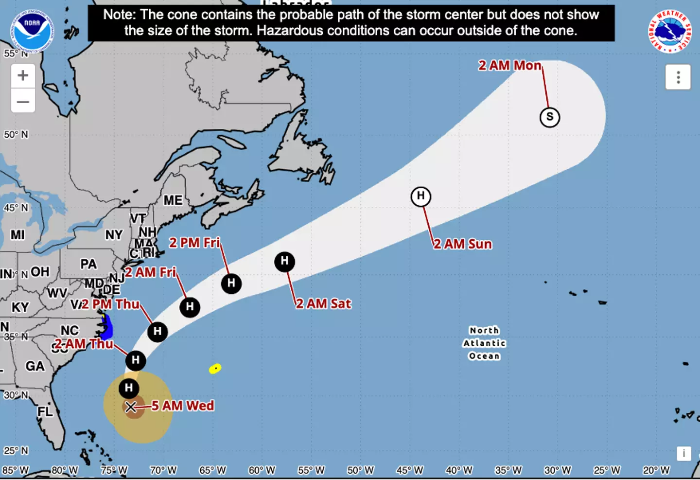
This morning (August 20), the NOAA issued a warning that the hurricane’s center is expected to pass between the East coast and Bermuda from today through early Friday before continuing past Canada.
The NOAA advised via Twitter: “NOAA is monitoring water levels and winds for Hurricane Erin, which is expected to produce life-threatening surf and rip currents along the beaches of the Bahamas, much of the east coast of the U.S., Bermuda, and Atlantic Canada during the next several days.
“These rough ocean conditions are expected to cause life-threatening surf and rip currents.”
The NHC announced this morning that a storm surge warning is in effect for North Carolina’s Outer Banks from Cape Lookout to Duck. A tropical storm warning is also in place for the next 36 hours from Beaufort Inlet, North Carolina, to the North Carolina/Virginia border, including Pamlico and Albemarle sounds.
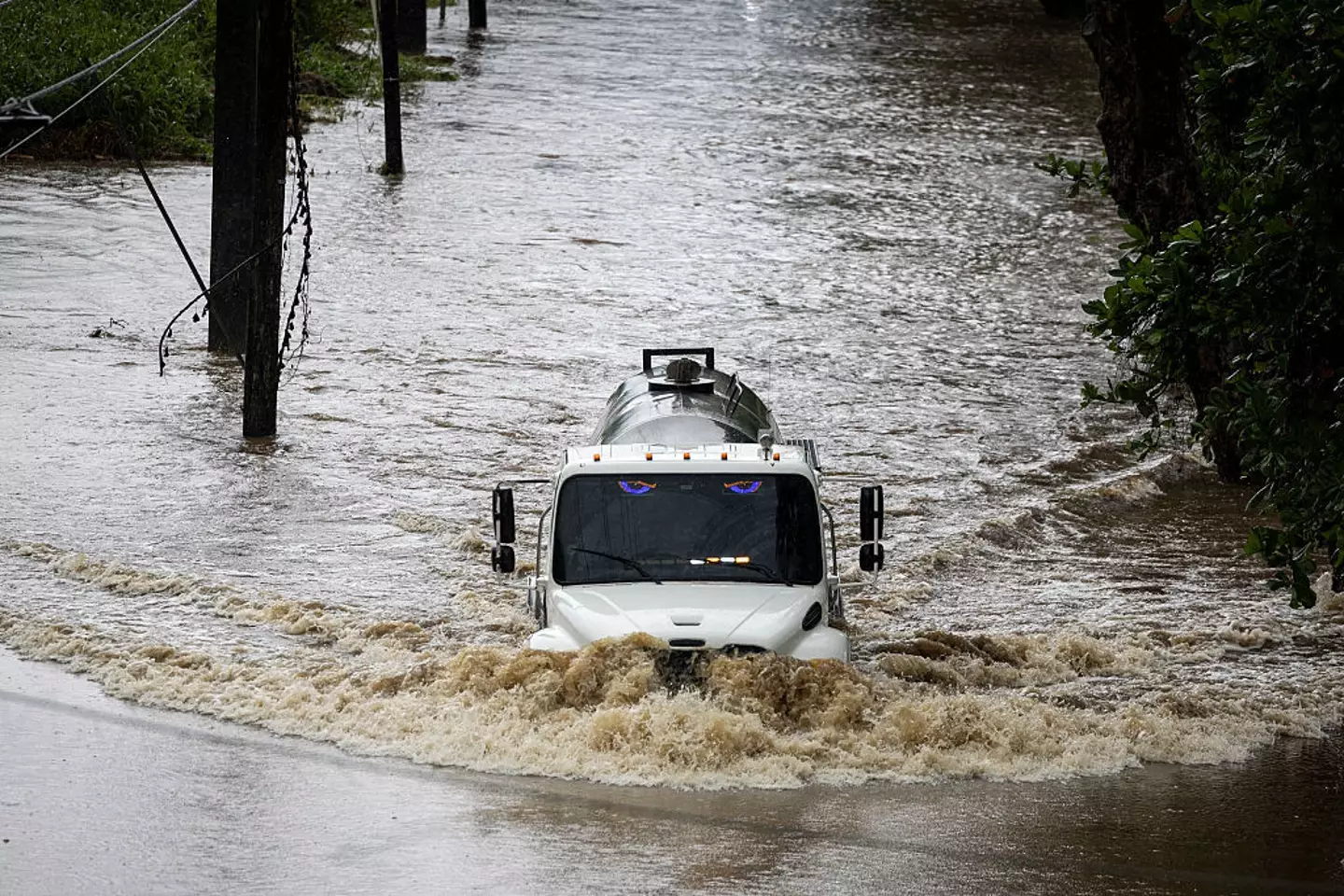
On Sunday (August 17), the outer bands of Erin impacted regions of Puerto Rico and the Virgin Islands with heavy rain and winds, causing power outages for thousands.
Officials in the Turks and Caicos Islands confirmed that all services were halted on three islands, instructing residents to stay indoors.
Hurricane Erin is anticipated to cause significant disruption, particularly in Bermuda.
Although Bermuda won’t experience the full force of the storm until the evening of August 21 (tomorrow), acting Minister of National Security Jache Adams highlighted that storm surges would render waters too hazardous for swimming, surfing, or boating.
Given Erin’s expected strength throughout mid-week, the hurricane center’s Richard Pasch informed PBS: “You’re dealing with a major hurricane. The intensity is fluctuating. It’s a dangerous hurricane in any event.”
The NHC’s update indicated that water levels could rise two to four feet above ground along the North Carolina coast (Cape Lookout to Duck).
“The combination of a dangerous storm surge and the tide will cause normally dry areas near the coast to be flooded by rising waters moving inland from the shoreline,” the agency stated. “The water could reach the following heights above ground somewhere in the indicated areas if the peak surge occurs at the time of high tide.”
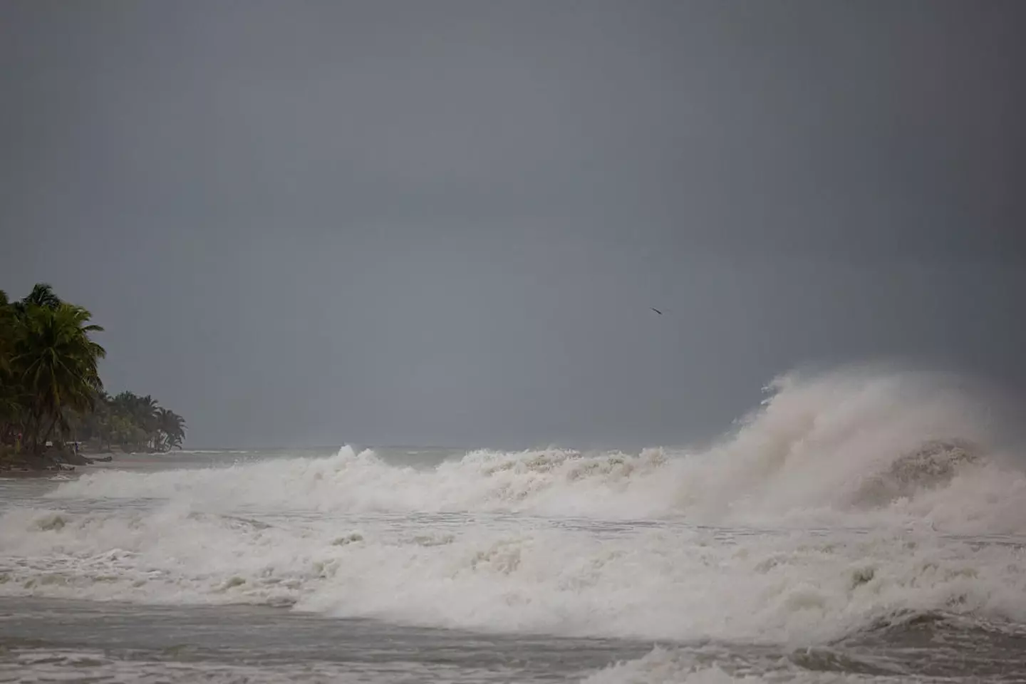
The National Hurricane Center and Central Pacific Hurricane Center have warned that it will be exceedingly dangerous for beach-goers to swim in the ‘next few days due to life-threatening rip currents’ as Erin changes direction.
Due to the potential hazards, North Carolina officials declared a state of emergency and ordered mandatory evacuations for Ocracoke and Hatteras islands.
Even though Erin currently does not appear likely to make landfall, it could still generate 20-foot waves and dangerous rip currents along the East Coast.
The storm and accompanying high waves may also result in beach erosion, overwash, and obstructed roads.
The latest information reveals that Erin is expanding in size, with tropical-storm winds extending closer to the Mid-Atlantic and southern New England coasts towards the end of this week.