A powerful typhoon has rapidly intensified in the Pacific Ocean, prompting urgent warnings as it moved towards vulnerable island communities.
Super Typhoon Sinlaku developed to the southeast of Guam and rapidly escalated into a Category 5 system, as forecasters tracked its progression in an environment that enabled unusually fast strengthening.
High sea-surface temperatures combined with minimal wind shear provided ideal fuel for the cyclone, driving its winds to extreme levels and placing the Northern Mariana Islands squarely along its projected route.
Authorities cautioned that the approaching storm represented an ‘extremely dangerous threat’, urging people in the region to take immediate steps to protect themselves and their homes.
As Sinlaku continued to intensify, it became one of the strongest typhoons observed so early in the calendar year, adding to concern among meteorologists and emergency officials.
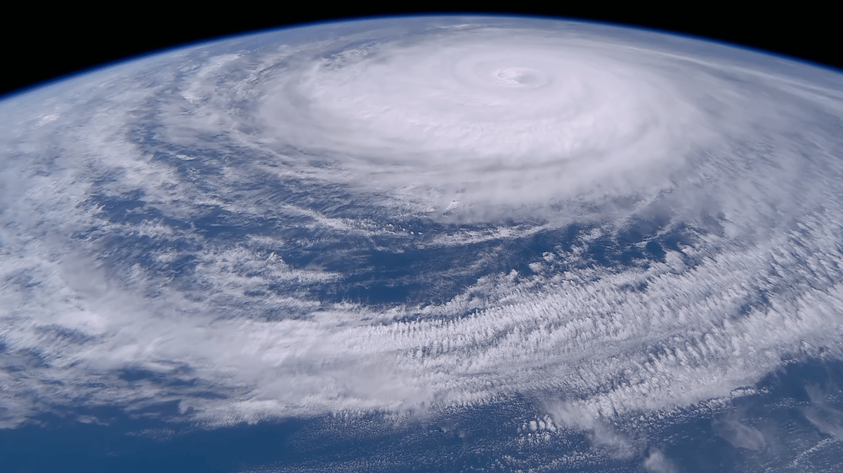
After the storm reached its maximum strength, new footage surfaced that showed the system from a strikingly different vantage point.
Recorded from orbit and shared via YouTube, the clip—captured using Sen’s cameras aboard the International Space Station—shows the typhoon’s enormous footprint: a vast spiral of cloud stretching across the Pacific with a sharply defined eye at its core.
The storm’s organisation appears almost textbook from above, with tight, symmetrical bands wrapping around the centre—an alignment often associated with the most intense tropical cyclones—yet the orderly structure only underscores its immense scale.
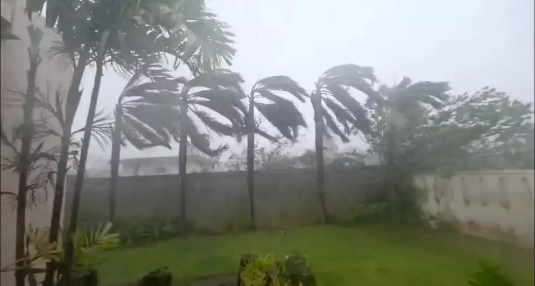
That calm-looking overhead perspective contrasted sharply with what people experienced on the ground.
Sinlaku later struck Saipan and Tinian—home to roughly 50,000 residents—bringing powerful winds and heavy, sustained rainfall that disrupted daily life and damaged infrastructure.
Reports described roofs being ripped away, trees pulled from the ground, and some vehicles flipped as the typhoon hammered communities over successive hours.
One resident said, as reported by NPR: “I hope people will take an interest and help. The damage is really huge here,” one resident said.
Early assessments also pointed to flooding, fallen power lines and damage to buildings across impacted areas, while officials continued to advise residents to stay indoors as hazardous conditions persisted.
At landfall, Sinlaku was producing sustained winds of around 150mph, with even stronger gusts measured as the core passed close to the islands.
Despite the severity of the storm, officials said there were no immediate reports of deaths, crediting advance alerts and widespread sheltering for limiting harm.
Across Guam and the Northern Mariana Islands, more than 1,000 people were accommodated in emergency shelters while the typhoon moved through.
Meteorologists highlighted the storm’s rapid intensification as a major worry, noting that Sinlaku surged in strength dramatically within about 24 hours.
Typhoons reaching this level so early in the year are relatively rare, prompting renewed attention on the atmospheric and ocean conditions that can allow such powerful systems to form and escalate quickly.