Hurricane Erin has prompted severe warnings for residents in its path, and there’s a significant reason for concern.
The hurricane season, spanning from June 1 to November 30, has brought Hurricane Erin alarmingly close to the United States.
Initially classified as a Category 1 storm, Hurricane Erin rapidly escalated to a Category 5 hurricane within 24 hours, as reported by CNN.
Authorities have issued warnings in various regions, advising people to avoid coastal areas.
The National Hurricane Center (NHC) stated on Saturday (August 16): “Erin is expected to produce life-threatening surf and rip currents along the beaches of the Bahamas, much of the east coast of the US, and Atlantic Canada next week.”
What makes these warnings particularly concerning?
Hurricane Erin is among the 43 recorded Category 5 hurricanes in the Atlantic.
According to the National Weather Service, Category 5 hurricanes are characterized by wind speeds ranging from 130 to 150 mph, capable of causing ‘catastrophic damage’.
The service warns: “Well-built framed homes can sustain severe damage with loss of most of the roof structure and/or some exterior walls.”
“Most trees will be snapped or uprooted and power poles downed. Fallen trees and power poles will isolate residential areas. Power outages will last weeks to possibly months. Most of the area will be uninhabitable for weeks or months.”
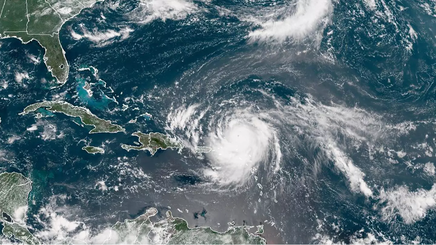
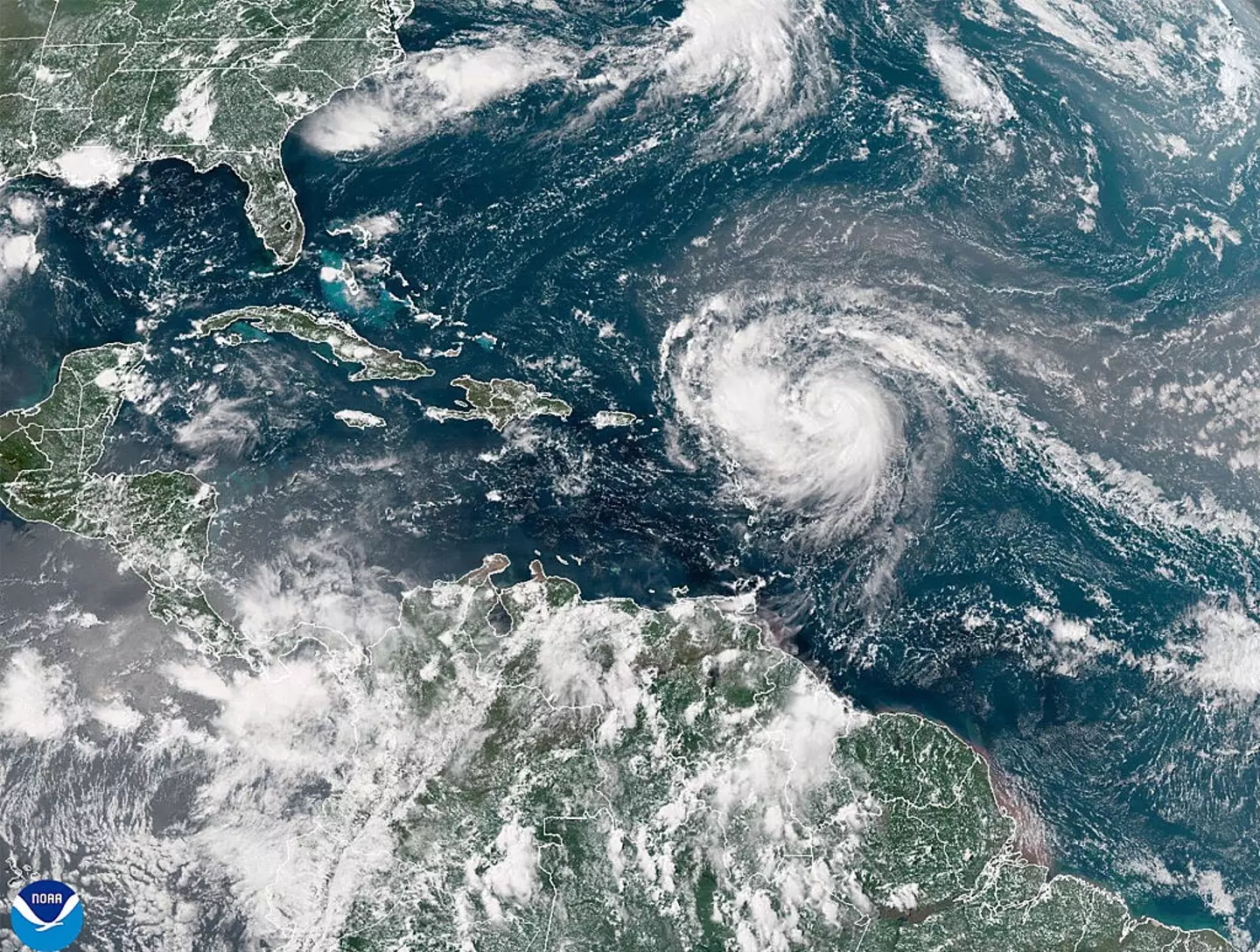
Erin originated as a tropical storm west of Cabo Verde, then moved across the Atlantic, intensifying into a hurricane by Friday (August 15). It continued to strengthen through a process known as rapid intensification.

Although it reached Category 5 status on Saturday while in the Caribbean, it was later downgraded to a Category 4 as it weakened, according to the NHC.
While it is not expected to make landfall in the continental United States, its potent winds pose risks such as landslides and other damage.
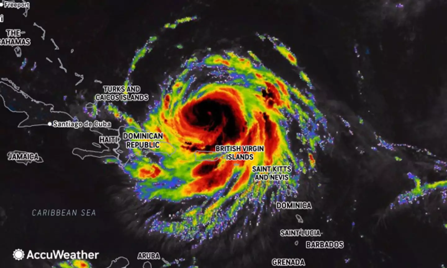
A Tropical Storm Watch has been issued for the British Islands to the southeast by meteorological services in the Turks and Caicos Islands.
Despite being downgraded to a Category 3 early Sunday morning (August 17), Erin is projected to regain Category 5 status before approaching the U.S. coastline.
The phenomenon of rapid intensification, where a storm’s wind speeds increase by more than 58 miles per hour within 24 hours, played a role in Erin’s development.
David Parkinson, a CBS News weather producer, noted its tight core and minimal wind shear, creating ‘perfect conditions for rapid intensification’ over unusually warm waters.
Hurricane season usually peaks in mid-September, making Erin’s current strength and rapid escalation atypical for this time of year.
Such power and unpredictability can complicate governmental preparations.
Rapid intensification can lead to coastal flooding, heavy rainfall, and more.
For Hurricane Erin, significant rainfall is anticipated across the northern Leeward Islands, the Virgin Islands, and Puerto Rico, with local flash and urban flooding, as well as landslides or mudslides, expected, as reported by the National Hurricane Center in Miami.
The last known Category 5 storm to rapidly intensify was Hurricane Milton, which downgraded to a Category 3 upon striking Florida, resulting in a dozen fatalities.
The NHC indicated that Hurricane Erin is set to pass over the northern Leewards, the Virgin Islands, and Puerto Rico, before remaining off the U.S. East Coast.