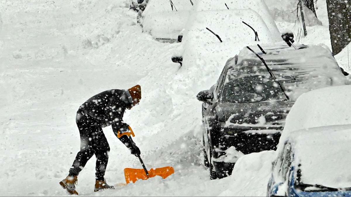
A powerful “bomb cyclone” is forecast to sweep across parts of the US, bringing heavy snow, blizzard conditions and dangerous winds that could make travel “near impossible” in some locations.
Beginning today (February 22), the National Weather Service (NWS) Weather Prediction Center said heavy snow and blizzard conditions are expected across “much of the Northeast and parts of the Mid-Atlantic,” according to a post shared on X.
🚨 Beginning Tomorrow 🚨
Heavy snow and blizzard conditions are forecast to impact much of the Northeast and parts of the Mid-Atlantic. Snowfall amounts of 1 to 2 feet are forecast and wind gusts up to 40-70 mph are possible along immediate coastal regions. pic.twitter.com/4hfyUTfij5
— NWS Weather Prediction Center (@NWSWPC) February 21, 2026
The center said some areas could see “one to two feet” of snowfall, while immediate coastal regions may experience wind gusts “up to 40-70 mph.”
The system is projected to remain in place into tomorrow afternoon. It’s being labeled a “bomb cyclone” due to how quickly it is expected to intensify.
CNN notes that a bomb cyclone refers to a storm that rapidly strengthens, marked by a pressure drop of 24 millibars within 24 hours.
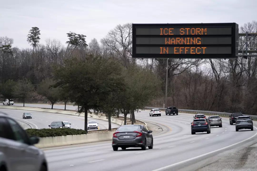
As of writing, weather advisories are in effect for 27 states, and New York City has received its first blizzard warning in nearly a decade.
CNN reported that blizzard warnings have been issued for various towns and cities across several states, including areas such as Western Norfolk, Northern Middlesex, Sussex, New York, Gloucester, and others.
Forecasts suggest Washington, DC could pick up between two and five inches of snow, while New York City could see totals in the 12-to-18-inch range.
Meteorologist Allan Nosoff also shared on X that he has seen “a model blend of nearly THIRTY INCHES in New York City”.
“This storm could rival that blizzard for one of the strongest EVER recorded in the city’s history,” he added.
However, he cautioned that “while 30 inches is possible, literal perfection has to occur with the banding location over the city,” and said his expectation remains closer to 12–20 inches.
Coastal New Jersey is currently expected to take the hardest hit from snowfall, with projections of 20–28 inches.
NWS Mount Holly posted to X: “Snowfall records are likely to be broken.”
The NWS has also outlined how the storm may affect normal routines, warning that snow could create “near impossible travel conditions,” with “sharply reduced visibility” making some areas “extremely treacherous.”
“These strong winds, combined with the weight of heavy, wet snow, will likely result in scattered to numerous power outages,” it added.
Forecasters are also calling for “moderate coastal flooding,” with the “inundation of roads and properties near the waterfront” considered most likely from Delaware to Cape Cod.
Pardon my French, but HOLY CRAP. ❄️🤯
I have NEVER seen a model blend of nearly THIRTY INCHES in #NYC, ever. Not even 2016 had THIS.
This storm could rival that #blizzard for one of the strongest EVER recorded in the city's history ⚠️ pic.twitter.com/kygl24bSJ0
— Allan Nosoff (@AllanWeather) February 21, 2026
The NWS urged people to prepare by ensuring their first aid kit is up to date, keeping phones charged and enabled for Wireless Emergency Alerts, and having warm blankets, clothing, and necessary medications on hand.
On Sunday, New York Governor Kathy Hochul declared a state emergency for multiple counties.
New Jersey Governor Mikie Sherrill also declared a state of emergency beginning Sunday at noon.
New York Mayor Zohran Mamdani said during a press briefing: “I am asking all New Yorkers to stay inside and stay off the roads for your safety.”
Most snowfall is expected to taper off by Monday evening.