A Florida sheriff has delivered a grave message to those who opted not to leave as Hurricane Helene hit the coast.
In some natural disasters, staying indoors can be the safest choice until the danger passes.
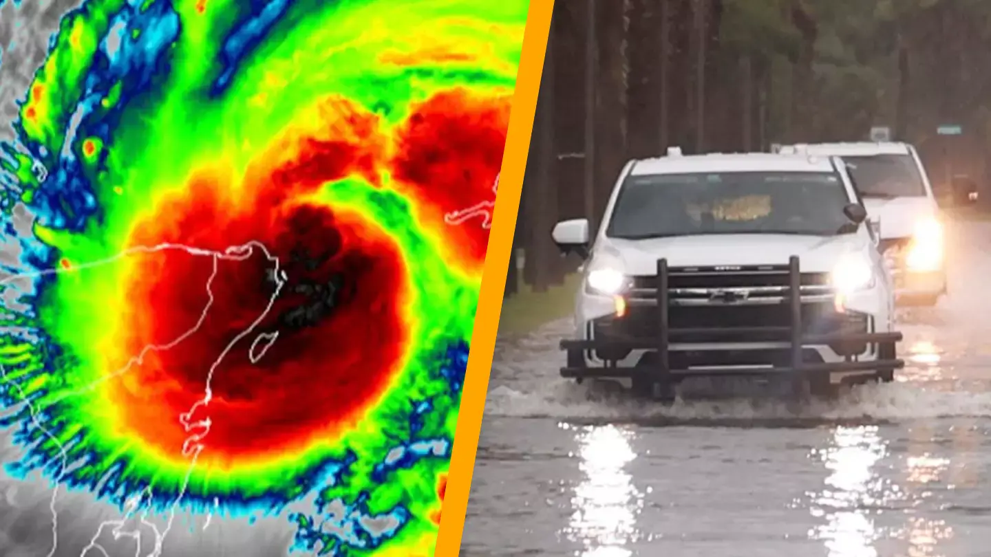
However, with Hurricane Helene reportedly claiming 33 lives and causing power outages for three million people, evacuations have been deemed necessary in certain areas.
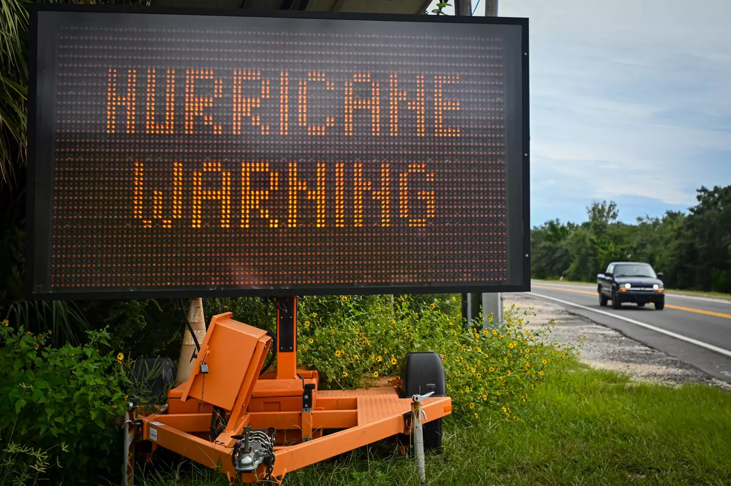
The Tallahassee National Weather Service has declared the storm ‘unsurvivable’, underscoring the importance of evacuation efforts.
Now, a sheriff has issued a disturbing request for those who ignored the repeated evacuation warnings.
The sheriff of Taylor County, Florida, a rural area located about an hour south of Tallahassee on the Gulf Coast, released a statement today on social media with a harrowing message for those who did not evacuate.
“If you or someone you know chose not to evacuate, PLEASE write your, Name, birthday and important information on your arm or leg in A PERMANENT MARKER so that you can be identified and family notified,” the post read.
The Taylor County Sheriff’s Office also provided instructions for those who were able to evacuate but are aware of people or animals that stayed behind. They advised emailing the department with essential details about their loved ones to facilitate focused search and rescue missions after Hurricane Helene.
They emphasized that the search and rescue emails should include critical information such as names, full addresses, the location of their homes, the names of residents still in danger, and the number of animals at any given address.
Due to Hurricane Helene’s power and intensity, including an anticipated 20ft storm surge, it is expected that some affected areas, especially in Florida, will be ‘uninhabitable’ for several weeks or even months.
While Florida was the first state to experience the storm’s impact, other states in the eastern U.S. and the Midwest are also projected to face Hurricane Helene’s effects.
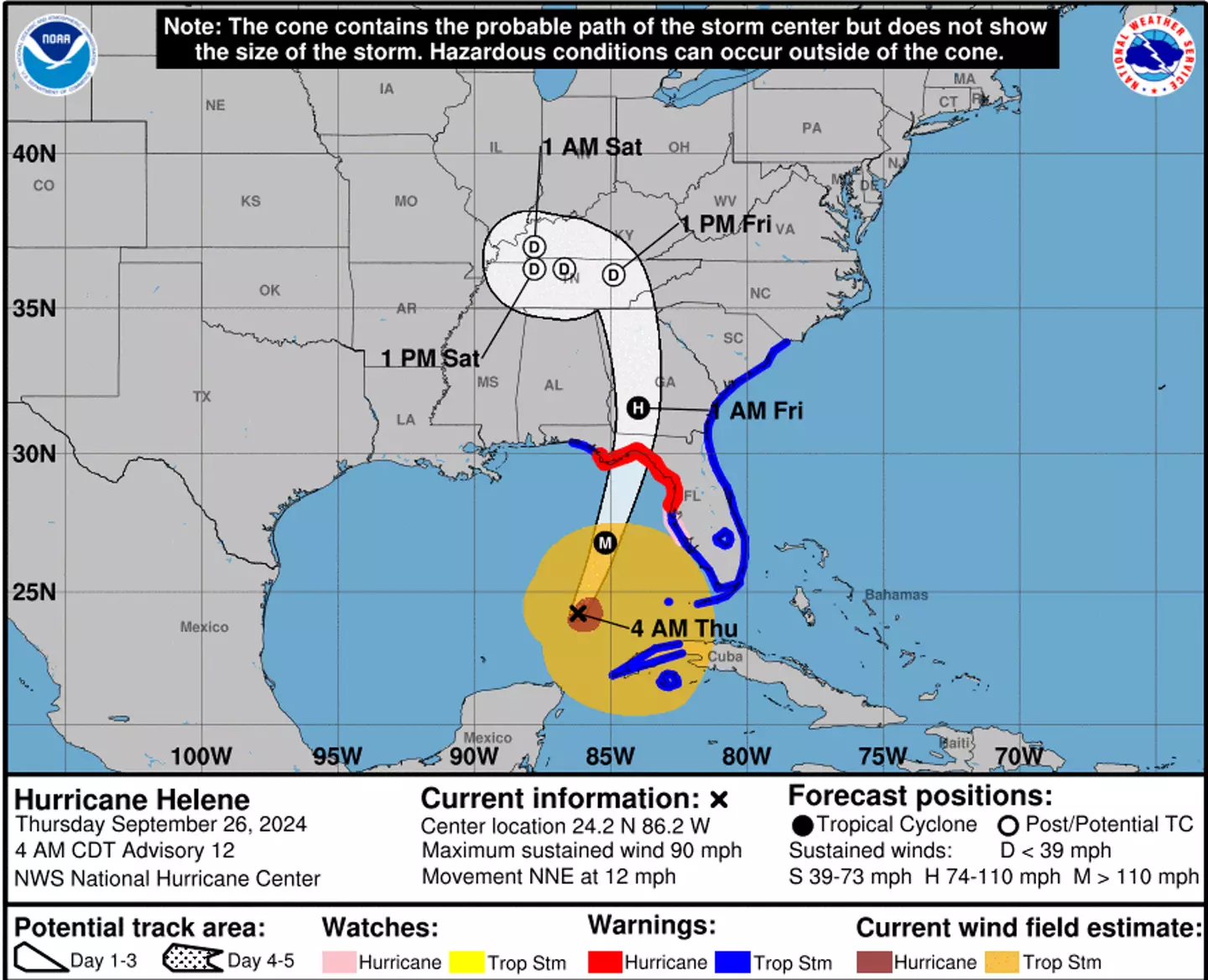
The latest updates from the National Hurricane Center indicate that the hurricane’s ‘eyewall’ began entering southern Georgia at 1am EDT this morning.
It stated: “Helene Weakening as it Moves Quickly North-Northeastward Near Valdosta Georgia. Life-Threatening Storm Surge, Winds, and Heavy Rains Continue.”
By 2am EDT on Friday, Hurricane Helene had started moving ‘rapidly north-northeast into southern Georgia’ with maximum sustained winds of 90mph and ‘higher gusts’.
By around 8pm, the hurricane is expected to move into Kentucky before making its way to Tennessee, South Carolina, North Carolina, and Alabama.