

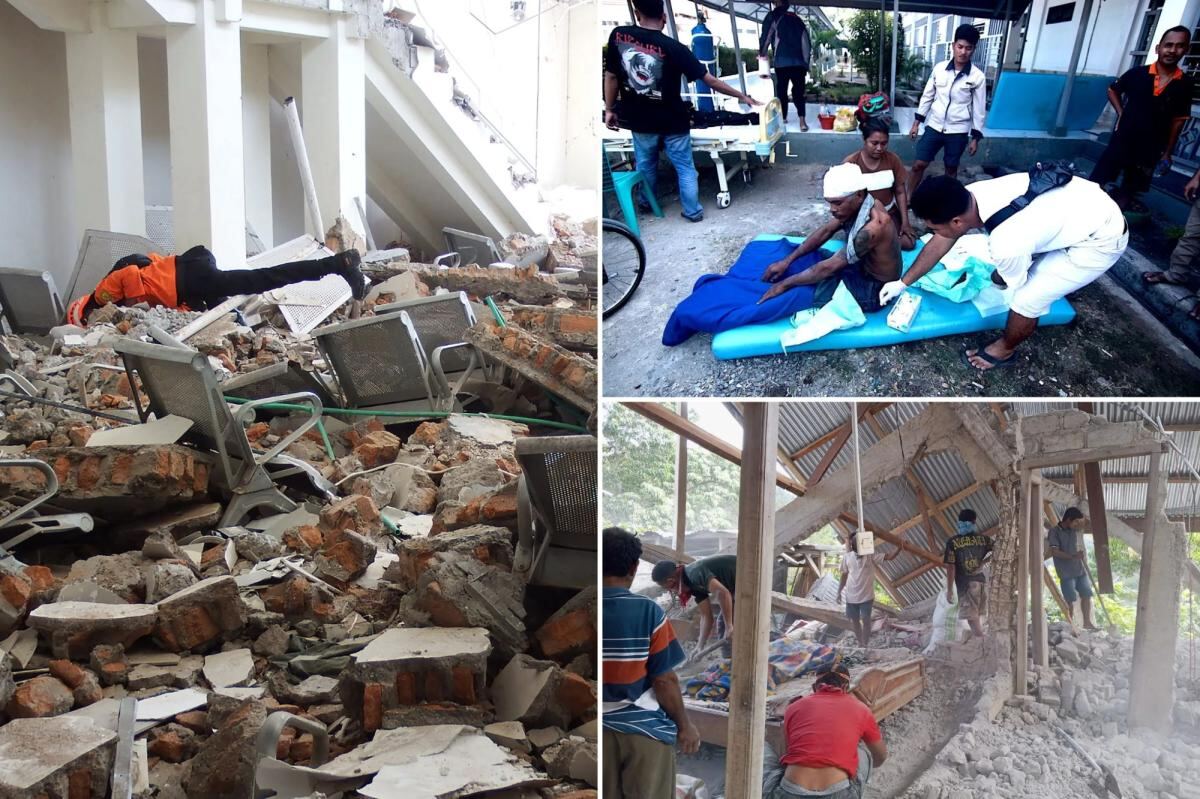
At least 20 people are dead after a magnitude 7.7 earthquake struck off Indonesia’s Flores coast early Saturday.
The quake hit at 5:58 a.m. Local time, according to the US Geological Survey, with an epicenter 42 miles north-northwest of Ende in East Nusa Tenggara province and a shallow depth of about 6.2 miles. Indonesia’s Meteorology, Climatology and Geophysics Agency, BMKG, recorded it at 4:58 a.m. Western Indonesian Time at a depth of 15 kilometers near Flores island. The initial tremor was followed by dozens of aftershocks, including three significant ones within the first half hour — magnitudes 5.9, 5.6 and 6.1 — and 111 total aftershocks counted by mid-morning.
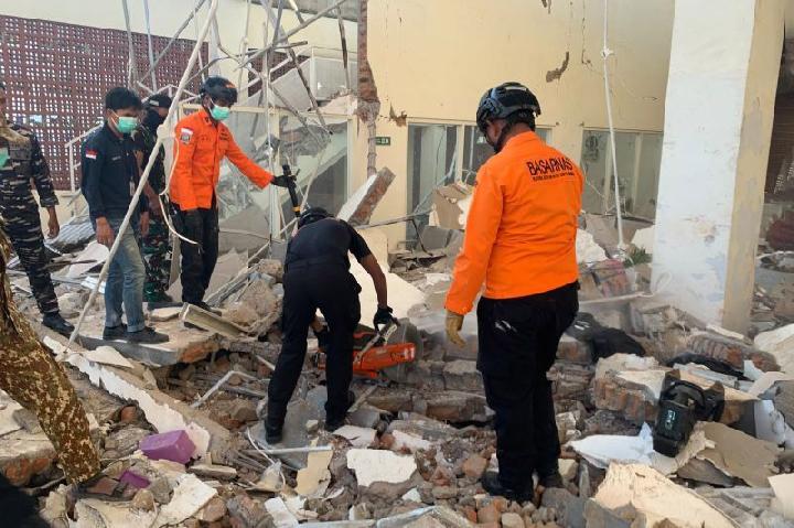
Fathur Rahman, head of the Maumere Search and Rescue Agency, said rescuers recovered at least 20 bodies across three devastated regencies: Sikka, West Manggarai, and East Manggarai. Eight of those bodies were pulled from a landslide in the village of Reok in Manggarai. Six people were rushed to nearby hospitals with severe injuries, and rescuers were still searching for two villagers believed buried under tons of mud from a quake-triggered landslide.
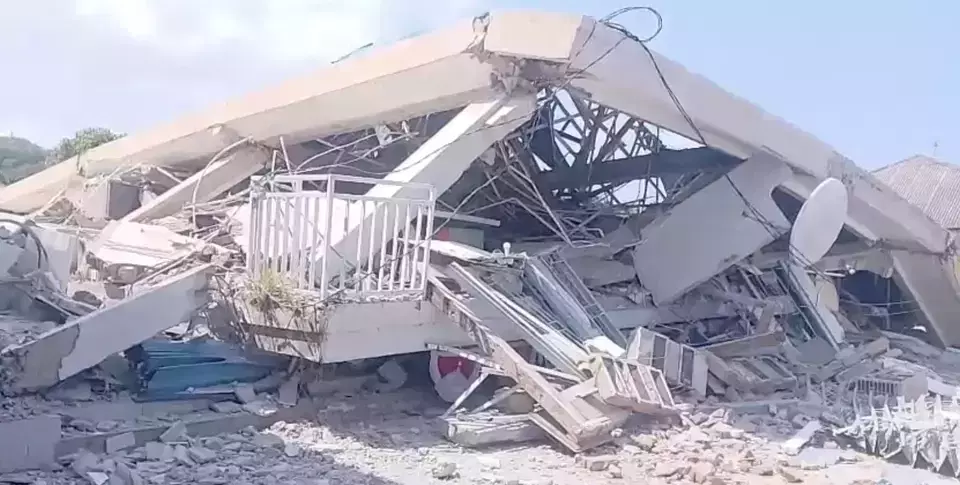
East Nusa Tenggara Police Chief Rudi Darmoko said the earthquake caused severe damage and collapsed buildings. Power outages in cities and villages hampered information flow and complicated search efforts.
“We are continuing to collect reports of damage and casualties, but there are communication disruptions,” Darmoko said.
He added that landslides in Ende regency triggered by the earthquake cut off the Trans-Flores highway, a roughly 435-mile paved mountain road spanning Flores Island from Labuan Bajo to Larantuka.
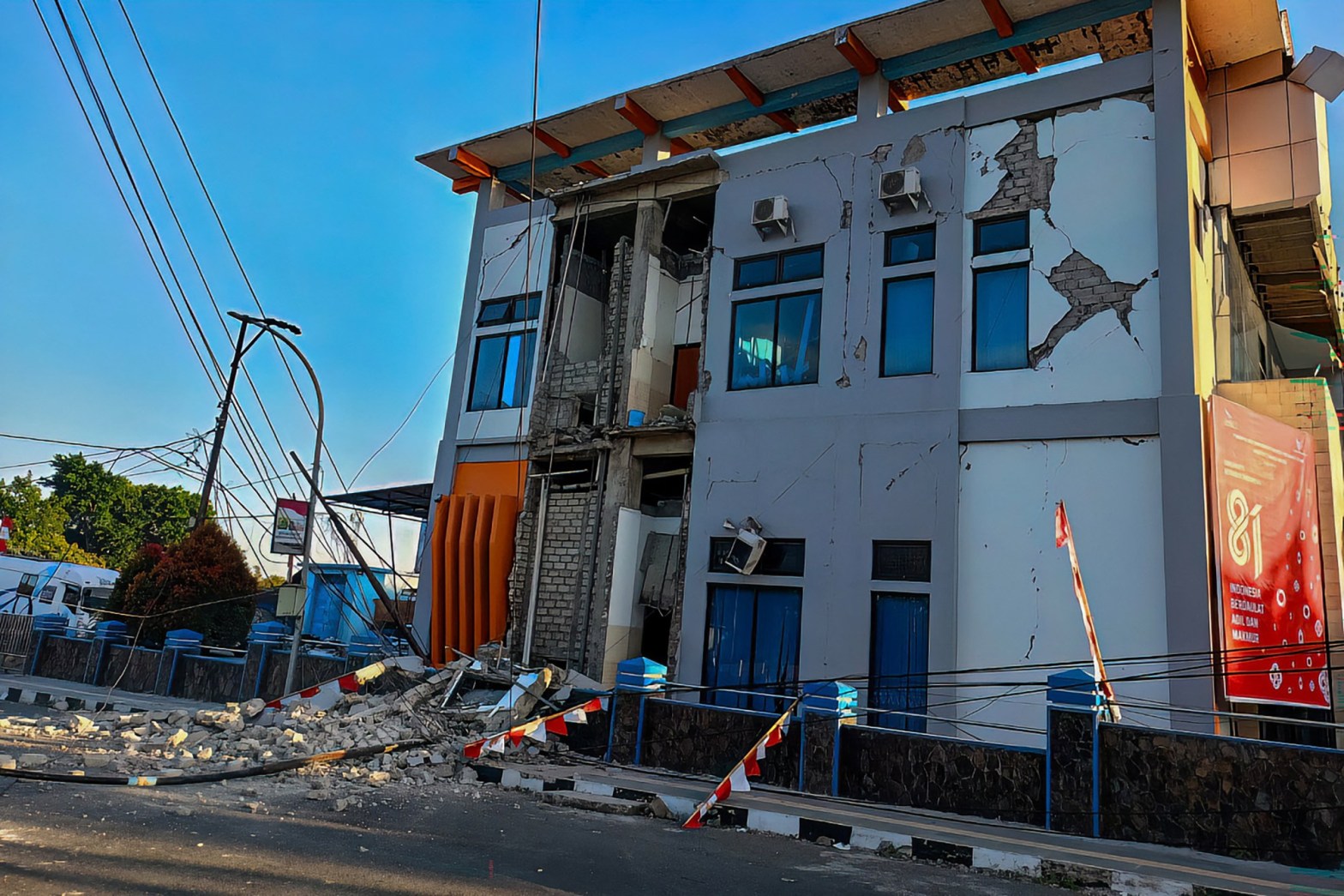
The governor of East Nusa Tenggara Province, Emanuel Melkiades Laka Lena, told a press conference that at least five people died from collapsing rubble as they slept. BMKG’s impact update at 12:30 WIB included 14 deaths: three in Sikka Regency, six in Manggarai Regency and five in East Manggarai Regency, with two seriously injured and 11 sustaining minor injuries. The National Disaster Management Agency, BNPB, initially reported one dead and four injured, saying figures remained under field collection and verification.
Yohanna Embu, a resident of Sikka regency, described the chaos as buildings crumbled.
“Many buildings here were damaged … I saw that the waiting room at the port terminal in Maumere had collapsed,” she said.
Footage verified by the outlet showed parts of a building collapsing into dust and rubble as people screamed and ran in the street at a port in Maumere.
Nona, a 51-year-old resident of Talibura, a village in East Nusa Tenggara, recounted the terror of the shaking.
“The quake was massive, the shock was so strong, we were resting at home with family,” she said. “There were 13 of us inside the house and we all ran to save ourselves.”
At St. Peter Major Seminary in Sikka, known locally as Ritapiret Seminary on the predominantly Catholic island of Flores, students attending morning Mass fled in panic when the roof of an assembly hall collapsed. The Rev. Guidelbertus Tanga, rector of the seminary, described the scene.
“Our students and nuns ran out in panic beneath a collapsing roof,” Tanga said. “At least one priest suffered a broken leg after jumping from the second floor of a building during the quake.”
Hospital staff moved equipment outdoors, including beds, IV stands and oxygen cylinders, and set up temporary treatment areas to adapt to emergency conditions. Footage on local television showed patients at several hospitals being evacuated as a precaution. The National Disaster Management Agency deployed a helicopter to assist with logistics and support emergency response operations, crucial given East Nusa Tenggara’s island geography and access challenges. About 2,000 villagers in Nagekeo regency fled to temporary shelters, and residents in coastal areas were evacuated to safer locations during the tsunami warning.
Indonesian authorities initially issued a tsunami warning for parts of East Nusa Tenggara, West Nusa Tenggara, South Sulawesi and Southeast Sulawesi provinces, urging residents to stay away from beaches and riverbanks. BMKG monitoring stations later recorded tsunami waves at 10 coastal sites, with the highest at 0.94 meters at Maurole-Ende, followed by 0.54 meters at Bulukumba. The warning was terminated about three hours after the quake when no significant sea-level threats remained.
Footage showed terrified residents fleeing buildings and streets as the powerful tremor struck, with structures visibly swaying and collapsing. The quake caused panic as far as Labuan Bajo, gateway to Komodo National Park, and damage was reported in Bima in neighboring West Nusa Tenggara province and parts of southern Sulawesi island. Teams had yet to reach Nagekeo, the region closest to the epicenter, with attempts by car blocked by landslides and another team attempting access by ferry.
Indonesia sits on the “Ring of Fire,” an arc of volcanoes and fault lines in the Pacific Basin that makes the archipelago of more than 17,000 islands prone to earthquakes and volcanic activity. BMKG identified the Flores Back-Arc Thrust as the source of this earthquake, citing the magnitude 7.5 Flores quake in 1992 as a previous major event in the same tectonic setting that produced damaging effects and a tsunami killing about 2,500 people.
Rescue and damage assessment operations are continuing across the affected regencies as authorities work to reach isolated areas and restore communications.