

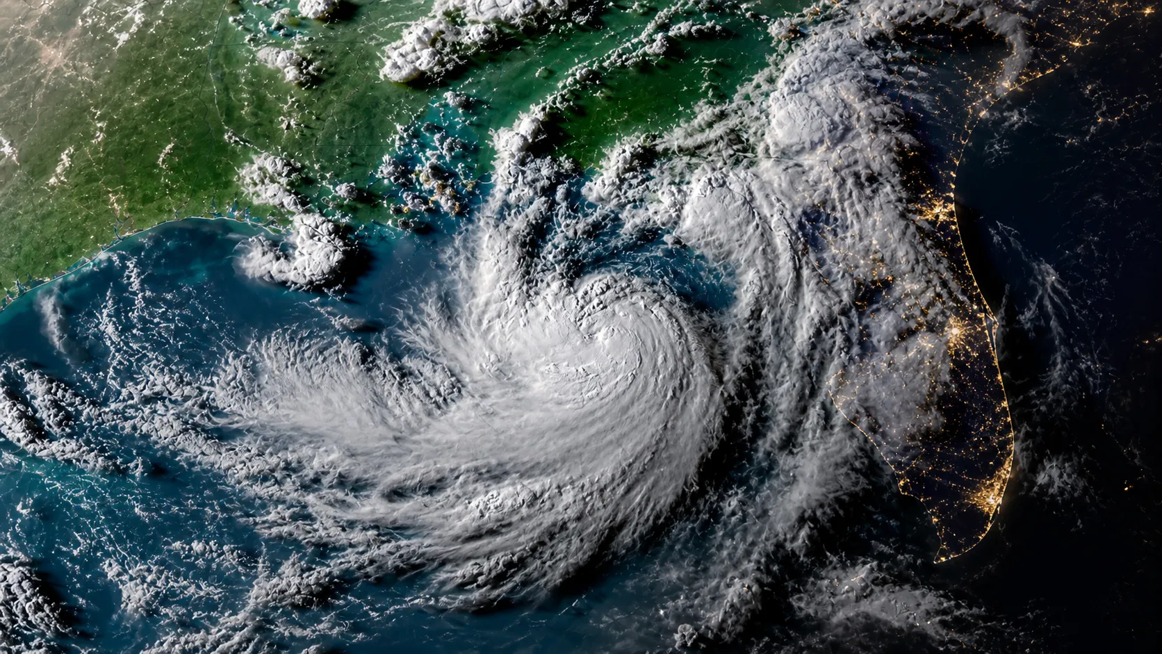
Tropical Storm Bertha has formed in the northeastern Gulf of Mexico and is tracking toward the U.S. Gulf Coast, bringing threats of heavy rain, flooding and coastal storm surge from Florida to Texas. The storm, which strengthened from Tropical Depression Two on Monday, becomes the second named storm of the 2026 Atlantic hurricane season.
As of Monday evening, Bertha was located approximately 110 miles south of Panama City, Florida, with maximum sustained winds of 40 mph. The system was moving slowly northwest at just 3 miles per hour in what forecasters described as an erratic motion. The National Hurricane Center forecasts that Bertha will continue moving slowly along the northern Gulf Coast before making landfall in southeast Louisiana late Wednesday or early Thursday morning, potentially near Plaquemines Parish south of New Orleans.
The tropical storm is expected to peak at around 50 mph in intensity before weakening, hampered by dry air, wind shear and its own large, disorganized structure. Persistent thunderstorms have formed only on the southern half of the system despite fuel from near-record warm Gulf water in the mid-upper 80s. There is a possibility the system could dissipate over Louisiana before reaching Texas, though the latest forecast calls for it to weaken to a tropical depression by late week as it moves toward the Upper Texas Coast.
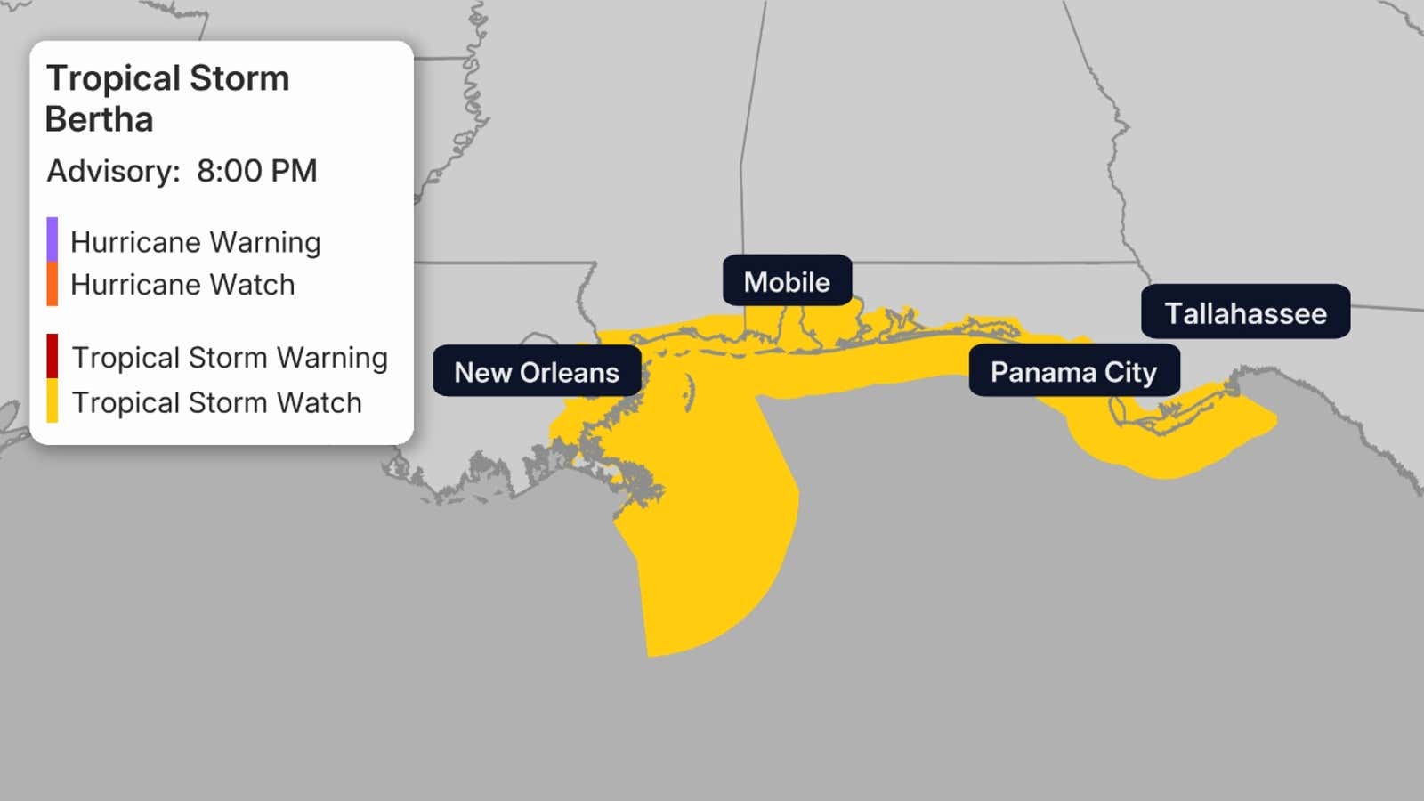
Tropical storm watches have been issued from the Ochlockonee River in the Florida Panhandle westward to Jefferson and Plaquemines parishes in Louisiana. Storm surge watches extend from the Alabama-Florida border to the mouth of the Mississippi River in southeast Louisiana. Tropical storm conditions are possible within these watch areas within the next 24 to 48 hours, with additional watches expected to be issued farther west along the Louisiana and Texas coasts.
The primary threats from Bertha include heavy rainfall, coastal flooding and tropical storm-force winds. Widespread rainfall of 2 to 4 inches is expected across the Gulf Coast from the western Florida Panhandle through Louisiana, with isolated areas possibly receiving up to 8 inches from the strongest thunderstorms. In New Orleans specifically, 3 to 5 inches are predicted, with areas south of Lake Pontchartrain likely to see more. Such rainfall amounts could trigger flash flooding, particularly in urban areas like New Orleans.
Storm surge poses another significant threat. Water levels could rise 2 to 4 feet above normal from the mouth of the Mississippi River to the Alabama-Florida border, with forecasters warning of potentially life-threatening coastal inundation, especially at high tide. Additional storm surge of 1 to 3 feet is possible for areas around Lake Pontchartrain and from Morgan City to the mouth of the Mississippi River.
Wind impacts are also expected. Tropical storm-force sustained winds of 39 mph or higher are possible in the tropical storm watch area of the Florida Panhandle Monday night into Tuesday, and in locations farther west late Tuesday night into Wednesday. Higher gusts within thunderstorms could cause isolated power outages. Wind shear will give Bertha an asymmetric structure, with the bulk of rainfall and wind concentrated to the south of the center, which could keep the greatest impact offshore but also means that if the storm tracks farther north than expected, more impactful weather would move onshore.
In preparation for the approaching system, Chevron Corporation announced it is suspending some operations in the Gulf, including shutting in production at its Petronius facility. The company is moving all associated personnel onshore and transporting nonessential staff from its Tubular Bells and Blind Faith platforms as storm preparedness procedures take effect.
Local communities along the Gulf Coast are also preparing for the storm’s arrival. Parish officials in Louisiana have opened sandbag distribution sites, with St. Tammany Parish opening five self-service locations on Monday at noon. New Orleans officials have activated emergency preparedness protocols, and New Orleans Sewerage and Water Board officials reported that 87 of 93 major drainage pumps were operational as they prepared for the incoming rainfall. Canal levels are being lowered and floodgates are being closed in advance of potential storm surge and flooding.
Before the storm arrives, the Gulf Coast will experience dangerous heat. A Heat Advisory was in effect Monday for southeast Louisiana and the Mississippi Gulf Coast, with heat index values reaching 104 to 108 degrees as temperatures climbed into the upper 90s. Forecasters expect conditions to remain dangerously hot through Tuesday before the tropical system brings clouds and rain.
Bertha follows Tropical Storm Arthur, which struck the Gulf Coast last month and brought heavy rain and minor flooding to Louisiana, Mississippi and parts of Texas. The 2026 Atlantic hurricane season got off to a slower start compared to recent years, influenced by El Niño conditions strengthening across parts of the basin. The National Oceanic and Atmospheric Administration has predicted a lower-than-average number of named systems this season, with 8 to 14 named storms expected overall. Of those, 3 to 6 are forecast to become hurricanes, with 1 to 3 reaching Category 3 strength or higher.
Forecasters emphasized there is still lower-than-normal confidence in Bertha’s exact intensity forecast, and adjustments to local weather predictions will likely be necessary as the system develops. All interests along the Gulf Coast from the Florida Panhandle to Texas have been advised to monitor the forecast closely for any changes. Residents in the region are being urged to monitor updates from the National Hurricane Center and local weather services as the storm approaches.